Transport Reality Capture, Integrated Reality Data Management Platform
Organization: Department of Transport and Planning (DTP)
Project Name: Transport Reality Capture, Integrated Reality Data Management Platform
Location: Melbourne, Victoria, Australia
Project Scale: 15,000 work hours
Expected ROI: 50% work hours saved by going digital and 20% uplift in data reuse
Bentley Software: Bentley Infrastructure Cloud, iTwin Capture Cloud Services, CESIUM
Project: Managing reality capture data across Victoria’s transport network
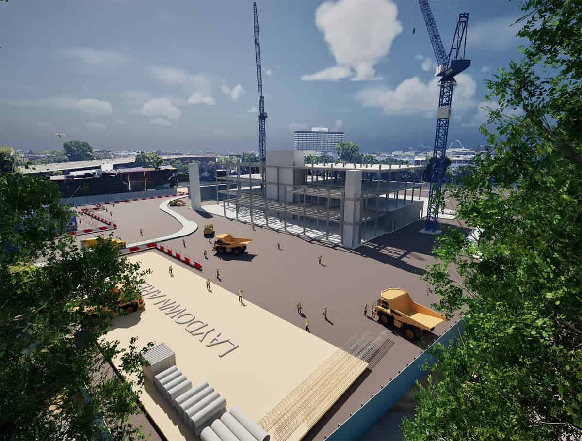
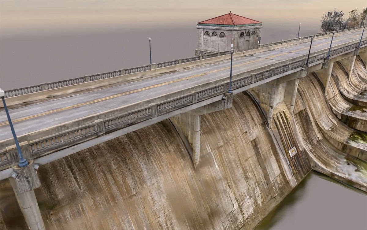
The Victorian Department of Transport and Planning (DTP) operates one of Australia’s most complex transport portfolios, managing thousands of kilometers of statewide road and rail corridors across metropolitan and rural areas. This made enterprise reality data management essential for improving access to point clouds, imagery, 3D models, and other transport asset data across the organization. With major capital initiatives like Victoria’s Big Build, DTP continuously captures massive amounts of high-resolution reality data—such as point clouds, imagery, and 3D models—to provide essential spatial context for planning, construction, and maintenance.
However, DTP recognized a critical challenge: they were capturing extensive data, but lacked an enterprise-level geospatial governance framework. Datasets were scattered across local drives, vendor platforms, and disconnected clouds. Historical corridors were often captured multiple times because existing data was duplicated, misplaced, or locked in proprietary platforms, severely limiting its reuse and causing unnecessary rework across the infrastructure lifecycle.
To solve this, DTP took visionary action. Acting as the asset owner and custodian, they redefined reality capture as a foundational digital asset rather than a fragmented project deliverable. By early 2025, DTP successfully completed and launched the Transport Reality Capture (TRC) initiative—a single, cloud-based enterprise data layer designed to scale with massive volumes of Big Build project data and serve as the authoritative spatial context for the entire state’s transport network.

Facts: Reality data management results
- Massive efficiency gains and reduced rework
By implementing a spatially indexed enterprise repository, workflows that previously took days are now completed within hours. DTP reported a 50% time savings in locating, validating, and accessing suitable reality datasets, automating repetitive tasks and significantly reducing rework.
- Increased data reuse and cost reduction
Enterprise-wide visibility virtually eliminated redundant data captures, driving an estimated 20% uplift in data reuse across projects. This directly translates to cost savings in survey mobilization, traffic management, and data processing.
- AI-driven asset extraction
DTP leveraged machine learning and computer vision for AI asset extraction directly from panoramic image analysis, accelerating asset cataloging across the state.
- Improved safety and sustainability
Remote, cloud-based access to high-resolution reality models reduced the need for physical site visits. This not only improved safety by limiting exposure to on-site risks but also lowered survey vehicle movements, field time, fuel use, and emissions.
Enterprise reality modelling delivers digital transformational change in efficiency and resilience across Victoria’s transport network. By transforming fragmented reality capture on Bentley Infrastructure Cloud using iTwin Capture Cloud Services, DTP reduced reality data discovery time by up to 50%, increased reuse by up to 20%, avoided repeat capture, and established a single authoritative geospatial foundation spanning the full asset lifecycle.
— Ban Chee, Reality Data Capture Manager, DTP

Solution: A cloud-based platform for enterprise reality data management
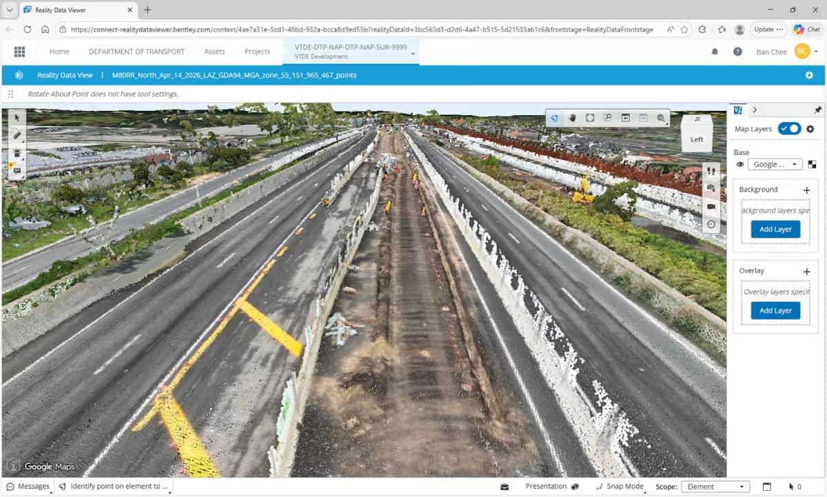
To execute their enterprise vision, DTP needed a robust management platform capable of decoupling massive reality datasets from individual tools and vendors. They achieved this goal by deploying iTwin Capture Cloud Services integrated with Bentley Infrastructure Cloud.
DTP processes their reality data using iTwin Capture Modeler to generate highly accurate 3D meshes and point clouds. Instead of trapping these files on local servers, they publish them directly into the cloud. In a global first, the reality management capabilities included in iTwin Capture Cloud Services allow DTP to host, secure, and manage discrete reality data (such as panoramic images used for asset audits) and seamlessly integrate it downstream into enterprise GIS and asset management systems.
This management breakthrough ensures that all reality data is validated against DTP standards, including defined coordinate systems and traceable lineage. Once published, the data can be consumed simultaneously across digital twins for immersive visualization, GIS platforms for spatial analysis, and emerging AI workflows—accessible securely from any project office via web platforms like Cesium.
Outcome: From fragmented files to governed transport digital twins
DTP’s enterprise data management strategy delivered immediate and measurable ROI on their investment. By unifying their reality data, DTP drastically reduced coordination issues, design validation risks, and lowered audit and contractual risks through standardized, controlled publishing workflows.
Furthermore, the reality management features within iTwin Capture Cloud Services unlocked temporal geospatial insights. By managing captures from multiple epochs within a consistent spatial baseline, DTP can now conduct wide-scale change detection, monitor asset conditions over time, and validate construction progress across Victoria.
By shifting from fragmented file creation to governed digital asset management, DTP has maximized the value of their capital investments. They successfully established a highly available, secure, and scalable foundation for AI-enabled spatial analytics, ensuring smarter, faster, and safer transport outcomes for the Victorian community.
Software: Bentley software used for reality data management
- Bentley Infrastructure Cloud: Provided the secure, highly available environment to host statewide transport reality data, reducing redundant on-premises storage and ensuring seamless access for distributed teams.
- iTwin Capture Cloud Services: Served as the core enterprise service to securely federate, host, and manage access rights to reality data, enabling temporal change detection, GIS integration, and intelligent AI asset extraction.
Ready to take control of your reality data?
Stop letting valuable reality data sit in disconnected silos. Just like DTP, your organization can turn fragmented files into a governed, enterprise-wide spatial layer. With iTwin Capture Cloud Services, infrastructure teams can securely process, manage, analyze, and share massive reality datasets in a connected cloud environment.
Explore how iTwin Capture Cloud Services unifies reality data ❯