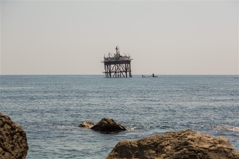
Offshore decommissioning is becoming a major engineering and delivery challenge as more offshore platforms, subsea wells, and pipelines reach the end of their service life. The offshore decommissioning market is projected to grow from USD 7.2 billion in 2026 to...
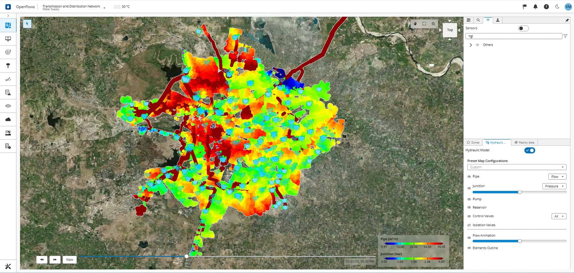
In Nagpur, a growing city in central India, delivering drinking water to more than three million residents depends on a vast network that most people never see. Beneath streets and neighborhoods, pumps, pipes, and valves work together to move water...
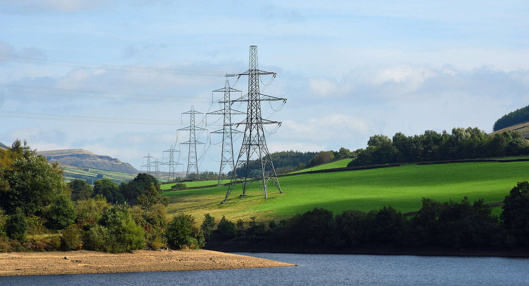
Three themes electric utilities are struggling with right now Last month in San Diego, Bentley colleagues joined over 18,000 industry leaders, engineers, and utility providers at DTECH 2026, the premier event for electric transmission and distribution. There’s unique energy at...
World Water Day is observed every year on March 22, and the 2026 campaign—“Where water flows, equality grows”—spotlights safe water and sanitation as fundamental human rights and critical enablers of gender equality. As communities and water utilities work to strengthen...
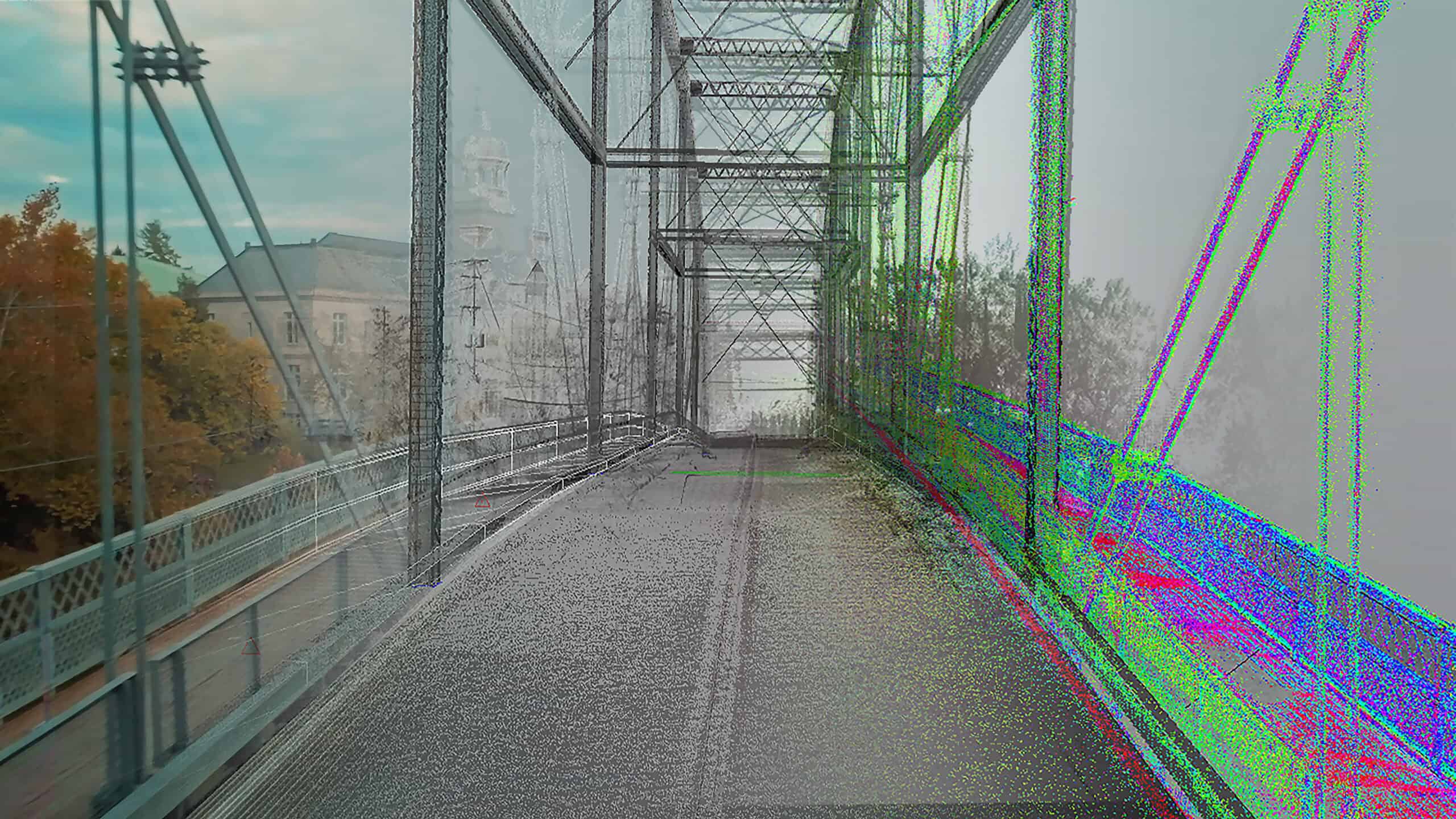
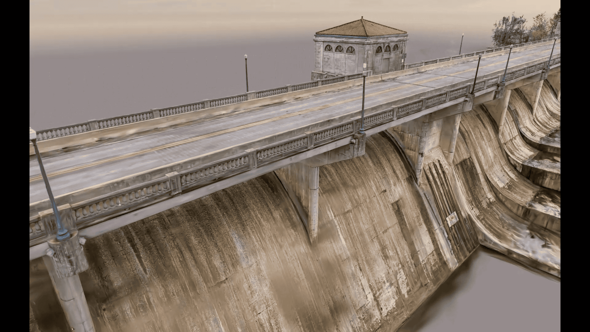
Bridges are lifelines, and aging infrastructure poses a significant challenge. Bridges connect communities, enable commerce, and ensure critical services can reach those in need. When these lifelines falter, the impact is felt deeply, from school routes to emergency response times....
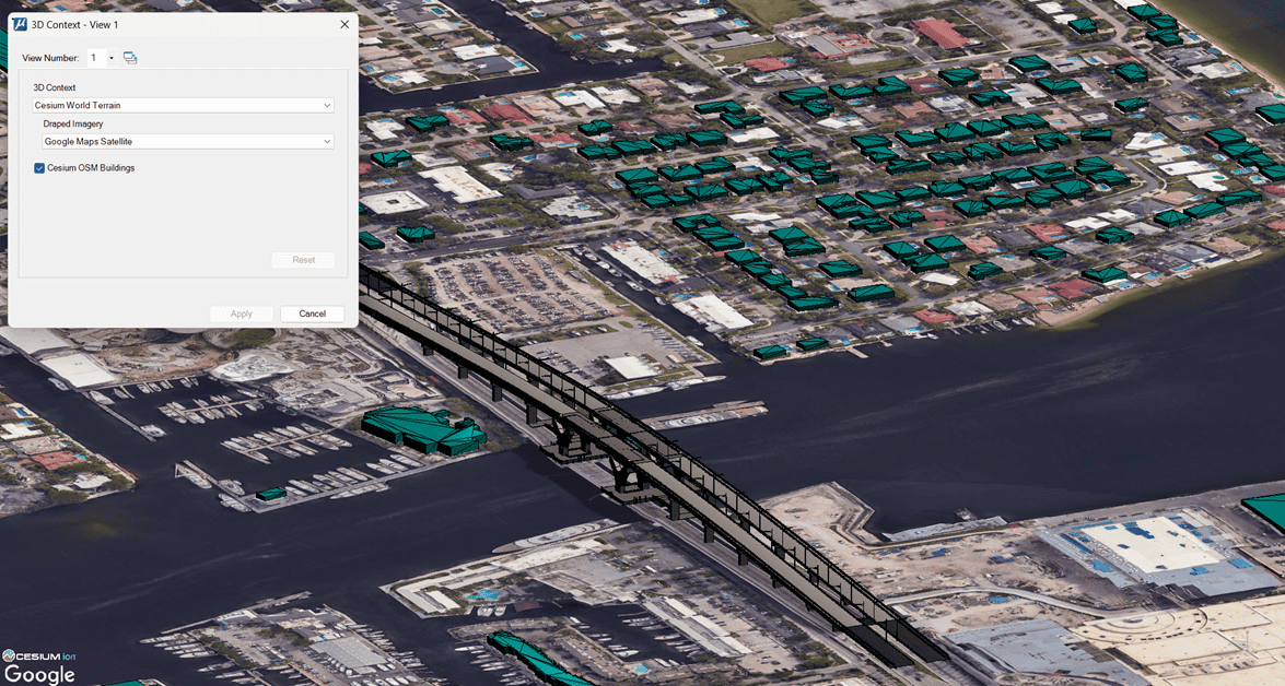
Digital twin workflows rely on precise reality capture software, accurate 3D reconstruction, and scalable infrastructure modeling tools to reflect real-world conditions. While mesh models have powered visualization for years, they limit fidelity—especially for fine geometry, transparency, and lighting. To overcome...
Infrastructure professionals across transportation, energy, water, and cities need modern CAD software to design, model, and deliver projects faster, smarter, and with greater context. Meeting these demands requires smarter, more connected ways of thinking about design, data, and delivery. With...
In the complex world of infrastructure, where sustainable design and digital innovation intersect, stories of successful project delivery often hinge not just on the software used, but on the individuals who master it. We recently spoke with Andrew Germain, an...
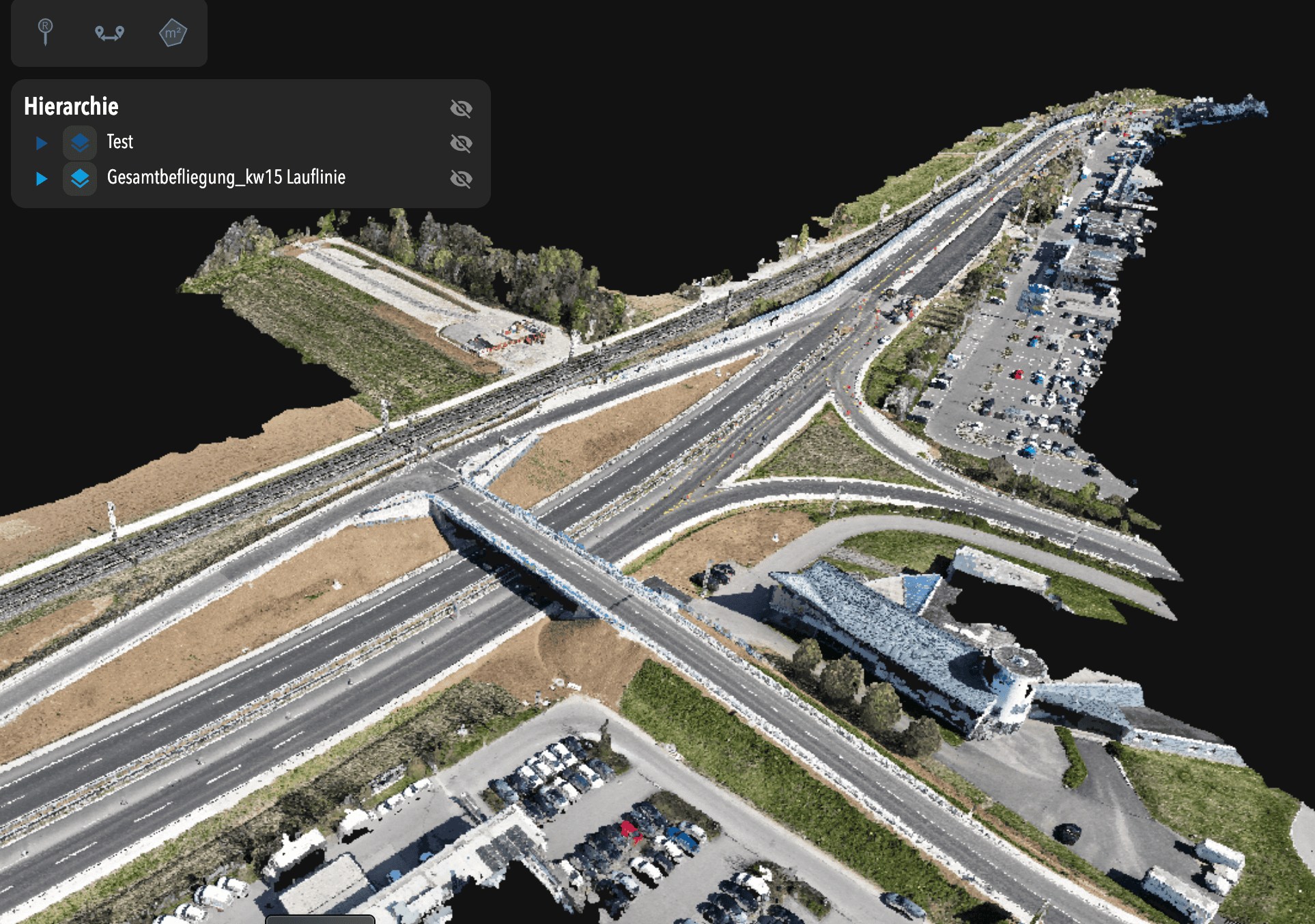
For Nicolai Nolle, CEO of Viscan GmbH, the goal was to deliver a high-accuracy digital twin for infrastructure construction—capturing and updating site conditions daily using advanced reality capture workflows. They were the digital backbone for the B29 highway expansion, a...