Like many places in the United States, the town of Perry, Iowa, started out almost as an accident. In 1849, a family from Delaware and another from Rhode Island parked their ox caravan in the area and decided that this would be as far west as they would go. The two families were soon joined by others, including two enterprising brothers, Harvey and John Willis, who convinced a local railroad to bring trains to the area from nearby Des Moines. In 1869, the train stop put Perry, named after a railroad official, on the map.
Today, Willis Avenue, which bears the name of the brothers, is one of the main arteries running through the bustling town of 8,000 people. An important piece of infrastructure, the road brings people in and out of the historic downtown and helps fuel Perry’s economic engine. But Perry is not only about the past. Town officials now have a digital twin of the entire city, including Willis Avenue, that provides a high-tech digital replica of Perry’s roads, sidewalks, buildings and other infrastructure. As a result, Perry represents a slice of America’s history and its urban digital future.
A better place to live
Just like Perry, the town’s digital twin started out as a happy accident. Local officials wanted to meet requirements in the Americans with Disabilities Act (ADA) to ensure that all residents could easily traverse the streets. “Our job at the City of Perry is to improve people’s quality of life,” said Sven Peterson, Perry’s city administrator. “We want to make Perry a better and easier place to live.”
During a professional development conference, Peterson shared the town’s plans with fellow Iowan Dave Overman, who worked as a project land survey specialist with Foth Infrastructure & Environment, a consulting firm specializing in engineering and environmental services. The two started talking, and the town soon hired Foth to help with the ADA work.
Hundreds of applications
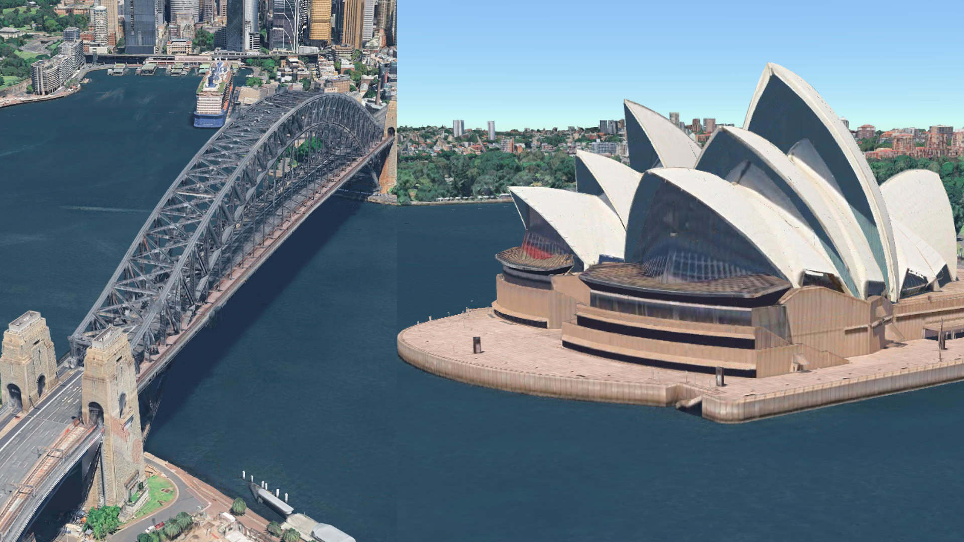
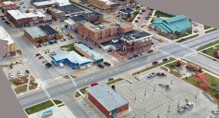 Foth processed 4.1 terabytes of information, into a detailed 3D reality mesh of the town. Courtesy of Foth.
Foth had experience in creating digital twins of busy sections of highways, but for the Perry project, the firm proposed creating a digital twin of the whole town to make the solution more useful. Peterson was not initially familiar with the concept of creating a detailed digital twin of an entire city, but he quickly realized the potential of the technology to help encourage his city’s development and improve the quality of life for residents. “We started having conversations and brainstorming how else this [project] could be used for the community, and how it could help us with the issues we face,” he said.
Foth brought in Bentley Systems, an infrastructure engineering software company that develops digital twin technology. The partners initially used a mobile LiDAR unit – a laser-based remote sensing technology – to capture images of street curbs for the town’s ADA compliance. Teams quickly realized they could easily expand the project by also capturing images of traffic signs, trees, buildings and other elements of the city – all without significantly increasing the project cost “The great thing about this scanning project is that you only have to scan once,” Peterson said. “You then have that data on hand and can use it for hundreds of other applications.”
Reality mesh
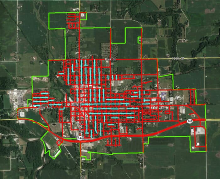 Imaging scan of routes throughout the City of Perry.
The teams found that a municipal digital twin had numerous benefits. Not only could it inform new development, it could also help improve city services like disaster preparedness, flood control and emergency vehicle dispatch. “Once we got into it, we realized how much possibility there was with using data to achieve a lot of different things from asset management and capital improvement planning to disaster recovery and even historic preservation,” Peterson said.
The partners scanned some 60 miles of streets, including Willis Avenue, and 10 miles of alleys. Teams captured 375,788 images of streets, sidewalks, buildings, signs, trees and other structures and objects. Using Bentley’s software, they turned the 4.1 terabytes of information into a detailed 3D reality mesh of the town. Bentley software then helped organize and process the data, and put the insights to use. “For a project of this size, Bentley was our only choice for storage and collaboration,” Peterson said.
The big picture
Perry’s downtown is part of the National Register of Historic Places, and the digital twin could also earn the city tax incentives by helping it meet the register’s standards. Peterson anticipates that the digital twin will increase the city’s ability to adhere to the tax incentives program by 50%, as well as improve historic building renovations and inspections by 25%. “A neighboring town had a tornado, which did a lot of damage to one of their historic buildings,” Peterson said. “They had to try to rebuild it just by using old photos. If one of our buildings gets damaged, we [now] have digital replicas of them.”
The replicas could also help the city enact its Comprehensive Plan 2030 – a package of infrastructure initiatives. “Our council and mayor are great at seeing the bigger picture and the direction we’re headed,” Peterson said.
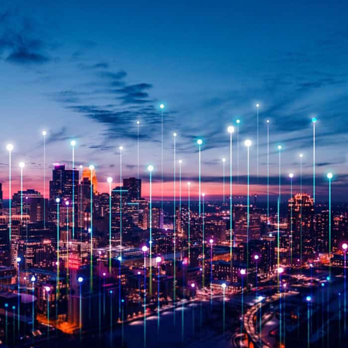
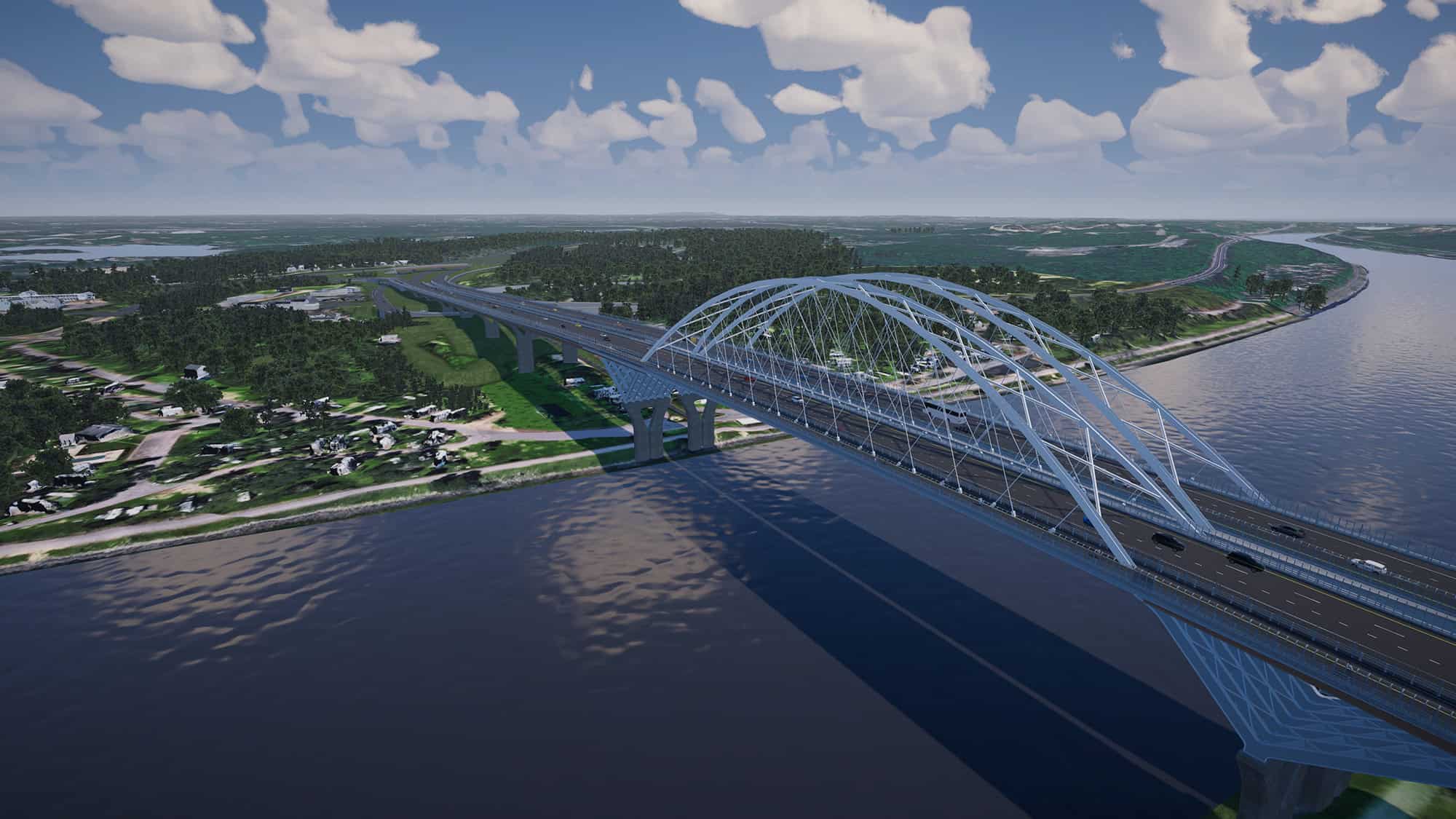
Thousands of digital twins are now in use worldwide, transforming the way we design, build and manage infrastructure. Notable examples include digital twins of Singapore, the HS2 high-speed rail line in the U.K., a new tunnel supplying New York City with water, and proposed improvements to alleviate congestion on Interstate 35, a critical highway and trade route connecting Canada, the U.S. and Mexico.
These digital models integrate real-time data from sensors, internet of things (IoT) and other sources and devices to reflect the state of the infrastructure. This continuous data feed, combined with historical performance records and sophisticated simulation capabilities, allows the digital twin to predict outcomes, simulate scenarios and provide visual representations that are remotely accessible.
Digital twins help during each step of a major project: They enable architects to design more resilient and sustainable infrastructure, builders to construct faster, and owners to analyze their assets with AI to operate more efficiently.
With a digital twin, all stakeholders are also looking at the same model. This collaborative experience improves communication among engineers, planners and maintenance teams, and helps ensure that all parties have access to the most up-to-date information.
In the town of Perry, a seemingly simple street upgrade project became a testament to the transformative power of digital twin technology. “We are entering the era of a digital twin for faster and better construction,” said Julien Moutte, Bentley’s chief technology officer. “AI tools and digital workflows are helping engineers to do their best possible work.”
Find out more about Bentley digital twins here.