
Manarah Urban Data Platform Project
Organization: Al Madinah Region Development Authority (MDA)
Project Name: Manarah Urban Data Platform
Location: Al Madinah, Saudi Arabia
Project Phase: Completed and Operational
Expected Completion Date: November 2024
Estimated Project Cost: USD 13.6 million
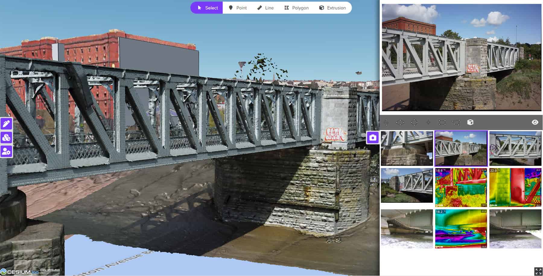
Bentley Software: iTwin Capture, Orbit 3DM, Cesium
Project
In Al Madinah—Islam’s second-holiest city and a spiritual hub since 622 CE—a quiet revolution is underway. The Madinah Region Development Authority (MDA) is reimagining the city’s future, aligning with Saudi Arabia’s Vision 2030 to welcome 30 million pilgrims annually. But this future isn’t just about expansion, it’s about balance: growing smartly while honoring centuries of heritage.
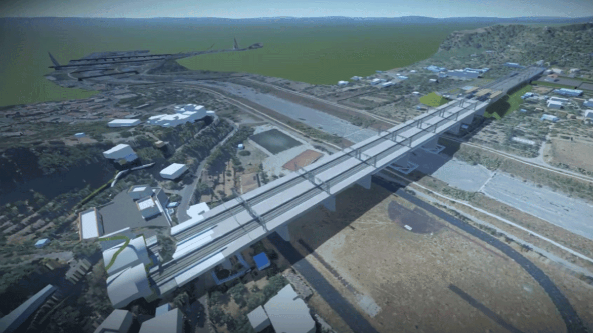
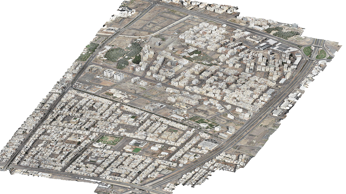
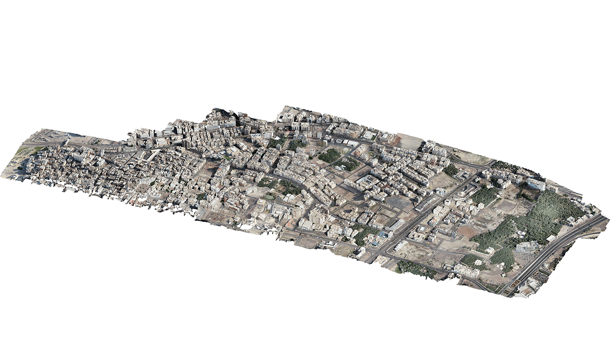
To support this vision, MDA launched a bold digital initiative: the Manarah Urban Data Platform (MUDP). Think of it as a living digital map of the city, built using drones, mobile mapping, and laser scans. Since 2018, MDA has modeled 55 square kilometers of urban space, scanned over 7,000 kilometers of roads, and documented more than 300,000 buildings and 18,500 businesses. It’s also digitally preserved 57 heritage sites—including the historic Aliyah Farms—and protected 26 square kilometers from urban sprawl.
Manarah isn’t just about data—it’s about impact. It helped redesign 172 kilometers of roads to support walking and cycling, including a three-kilometer corridor between the Prophet’s Mosque and Qeba Mosque. It’s been used to simulate floods, plan COVID-19 quarantines, and protect over a million residents. By going digital, MDA is making Madinah a global model for smart, inclusive, and resilient urban development.
Facts
-
Accelerated data capture
Reality modeling of 6.6 square kilometers completed in 16 days—43% faster than traditional methods. Over 7,000 kilometers of roads scanned, generating 1.04 million panoramic images and 7,104 kilometers of lidar runs published for transparency. -
Comprehensive urban modeling
High-resolution capture of 55 square kilometers, integration of 475 geospatial layers, and processing of more than 300,000 building facades across 31 districts, supporting zoning, planning, and service delivery. -
Smart city infrastructure
Verification of more than 18,500 businesses, implementation of more than 300 ISO-aligned indicators, and expansion of city area by 3.1% (from 677 to 698 square kilometers) with a 4.9% increase in farm area. -
Sustainability and resilience
Preservation of 1.45 square kilometers of urban farms and protection of 26.28 square kilometers from sprawl. 150,000 trees planted, 1.3 square kilometers of canopy added, and flood simulations for 112 millimeter per day rainfall enhanced disaster preparedness. -
Cultural and mobility enhancements
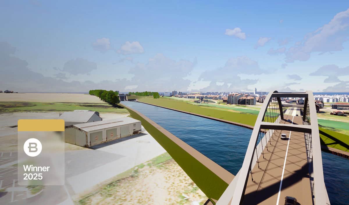
Documentation of 57 heritage sites fueling a USD 250 million preservation initiative. 172 kilometers of roads redesigned for pedestrians and cyclists, including a three-kilometer corridor linking key religious sites. 14 historic districts studied for modernization without demolition.
“Bentley’s iTwin Capture, Orbit 3DM Publisher, and Cesium empowered us to transform Madinah’s urban development with unprecedented speed, precision, and sustainability. This enabled smarter planning, safeguarded cultural heritage, and prepared our city for a resilient, data-driven future.”
Fayez Al Sayil, Director, Geographical Information Center (GIC) and Urban Observatory (UO)
Solution
Turning a historic city into a smart city isn’t easy. MDA faced major challenges: complex data, strict regulations, and the need for seamless collaboration across government agencies. After evaluating multiple technologies, they selected Bentley iTwin Capture tools for their high-quality visuals, processing power, and integration capabilities.
In early 2024, MDA deployed DJI Matrice 300 RTK drones to map 6.6 square kilometers in just 16 working days—saving 43% in survey time. The data was transformed into detailed 3D models using iTwin Capture and published via Orbit 3DM and Cesium, making it accessible across intranet and internet platforms.
Manarah unified 475 layers of geospatial data into a single digital environment, enabling real-time collaboration across more than 20 government departments. Bentley’s tools helped document over 300,000 building facades and analyze urban districts in 3D. Planners used exported models to study walkability in key areas like the Qeba corridor, while digital surface models powered flood simulations for extreme weather scenarios.
The platform also supported district-level quarantine planning during the pandemic, using accurate building and business data. By digitizing workflows, MDA improved transparency, reduced environmental disruption, and launched a USD 250 million heritage preservation initiative, demonstrating how innovation can protect both people and culture.
Outcome
MDA’s digital strategy delivered measurable impact. Survey time dropped by 43%, and planning accelerated across departments. The platform preserved 57 heritage sites, protected 26 square kilometers from urban sprawl, and supported a USD 250 million cultural initiative.
Smart modeling enabled flood preparedness and pandemic response, while walkability studies informed healthier urban design. MDA expanded the city by 3.1%, increased farmland by 4.9%, and planted 150,000 trees—adding 1.3 square kilometers of canopy.
By integrating Bentley’s tools, MDA reduced risk, saved time, and empowered data-driven governance. Madinah now stands as a global benchmark for sustainable urban transformation, where tradition and technology move forward together.
Software
iTwin Capture Modeler enables the user to automatically generate multiresolution 3D models at any scale and precision.
iTwin Capture Manage and Extract helps handle large datasets and extract actionable insights from reality models, supporting analysis across departments.
Bentley Orbit 3DM Publisher can publish and share reality data, ensuring seamless access across teams and stakeholders.
Cesium is a web-based 3D geospatial visualization engine for smooth, real-time rendering of reality models.
Explore how iTwin Capture and reality modeling tools can accelerate your smart city initiatives.
Bentley Year in Infrastructure (YII) and the Going Digital Awards is an annual event where global industry leaders come together to showcase infrastructure delivery and performance excellence and exchange visionary ideas for the future. Find out more on the YII site.