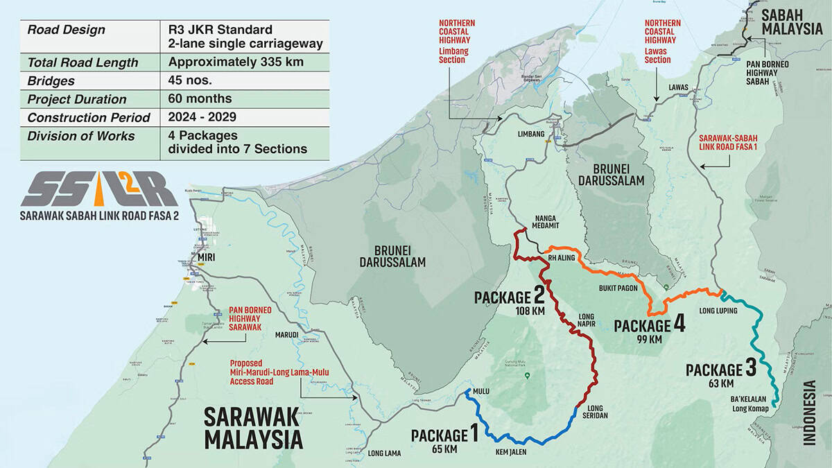
Sarawak Sabah Link Road Phase 2
Organization: Jabatan Kerja Raya Sarawak (JKRS)
Project Name: Sarawak Sabah Link Road Phase 2
Location: Limbang and Lawas, Sarawak, Sarawak
Project Phase: Construction
Expected Completion Date: June 23, 2029
Estimated Project Cost: MYR 7.15 billion
Bentley Software: Cesium, iTwin Capture, OpenCities Map, OpenRoads, ProjectWise, SYNCHRO
Additional Context: The need for this year-round access road was highlighted during the unexpected pandemic, when international borders were closed, cutting off communities overnight
Project
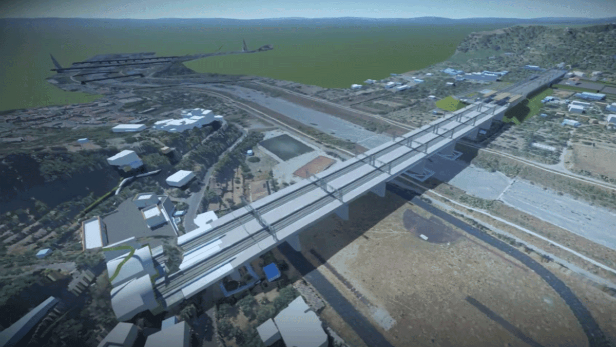
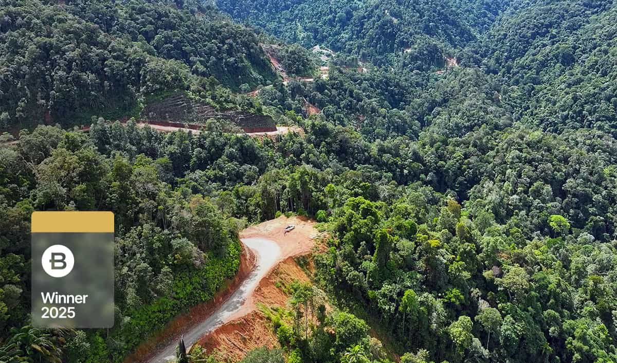
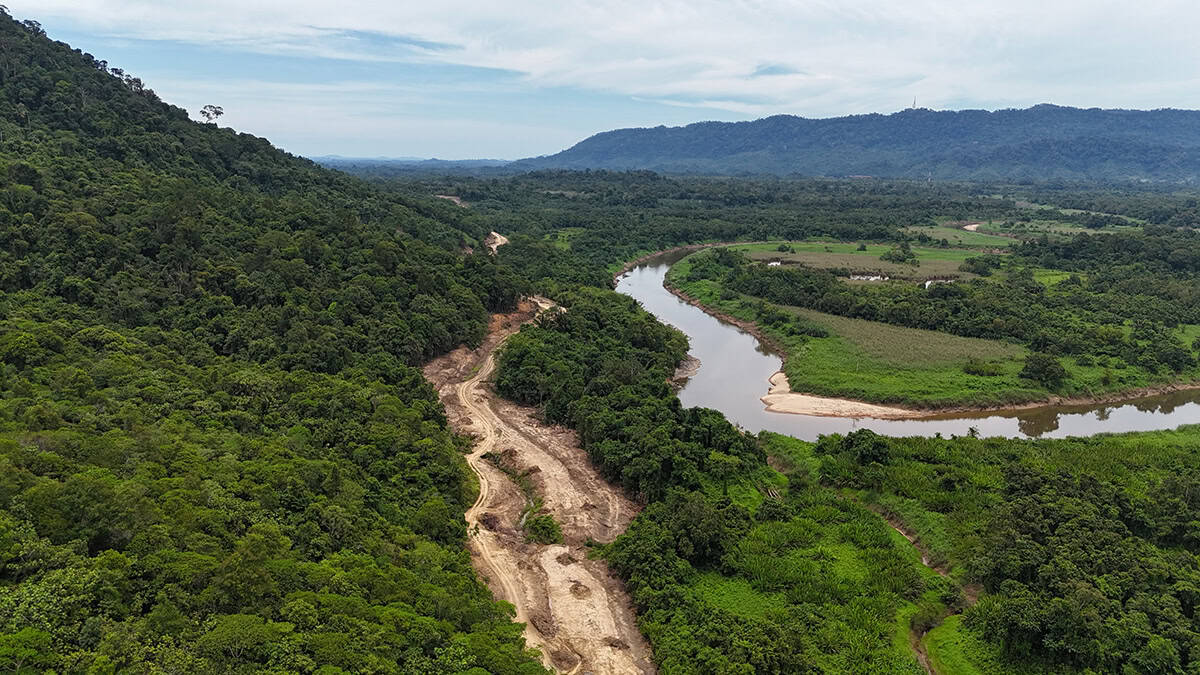
The Sarawak Sabah Link Road Phase 2 (SSLR2) project, led by Jabatan Kerja Raya Sarawak (JKRS), is the first continuous land link between the remote east Malaysian states of Sarawak and Sabah. Spanning 335 kilometers, it will not only enhance national mobility and socioeconomic growth, but also significantly improve access to education, medical care, and jobs for more than 70,000 residents in underserved communities—sparking economic activity in a region rich in agriculture and tourism potential.
But making this year-round connector road a reality didn’t come without its challenges. Mountainous terrain, varying soil conditions, and some of the heaviest rainfall in the country made construction especially difficult. On top of that, they had to manage multiple teams across hard-to-reach locations, navigate environmental sensitivities, address community concerns, and work through frequent design changes.
With only 60 months to deliver the entire project, the JKRS team needed to work in the most efficient and productive way possible. That’s why they decided to shift from using traditional 2D design processes and basic file sharing tools to a digital-first approach.
Facts
- Working in an integrated digital twin platform accelerated the design process by 50% and reduced overall project costs by 30%.
- The JKRS team minimized the impact on protected areas and wildlife by 80% and reduced the project’s carbon footprint by 30%.
- Bentley’s tools not only elevated project delivery, but also set a benchmark for future infrastructure initiatives in Malaysia.
“With Bentley software technology, we systematically collect, analyze, and manage data throughout the project lifecycle. Asset performance can be optimized, maintenance costs reduced, and public safety enhanced. Apart from maximizing the return on investment, we ensure sustainable infrastructure for generations to come by transforming roadway construction through digital twin excellence.”
– Cassidy Anak Morris, Director of Public Works, Sarawak
Solution
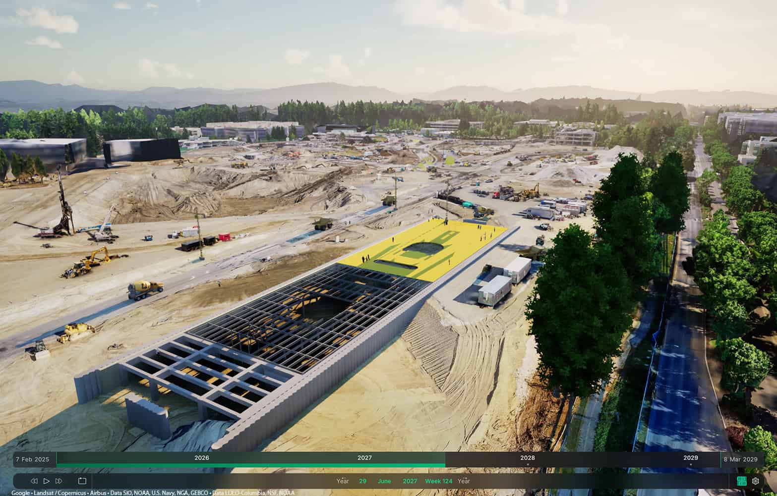
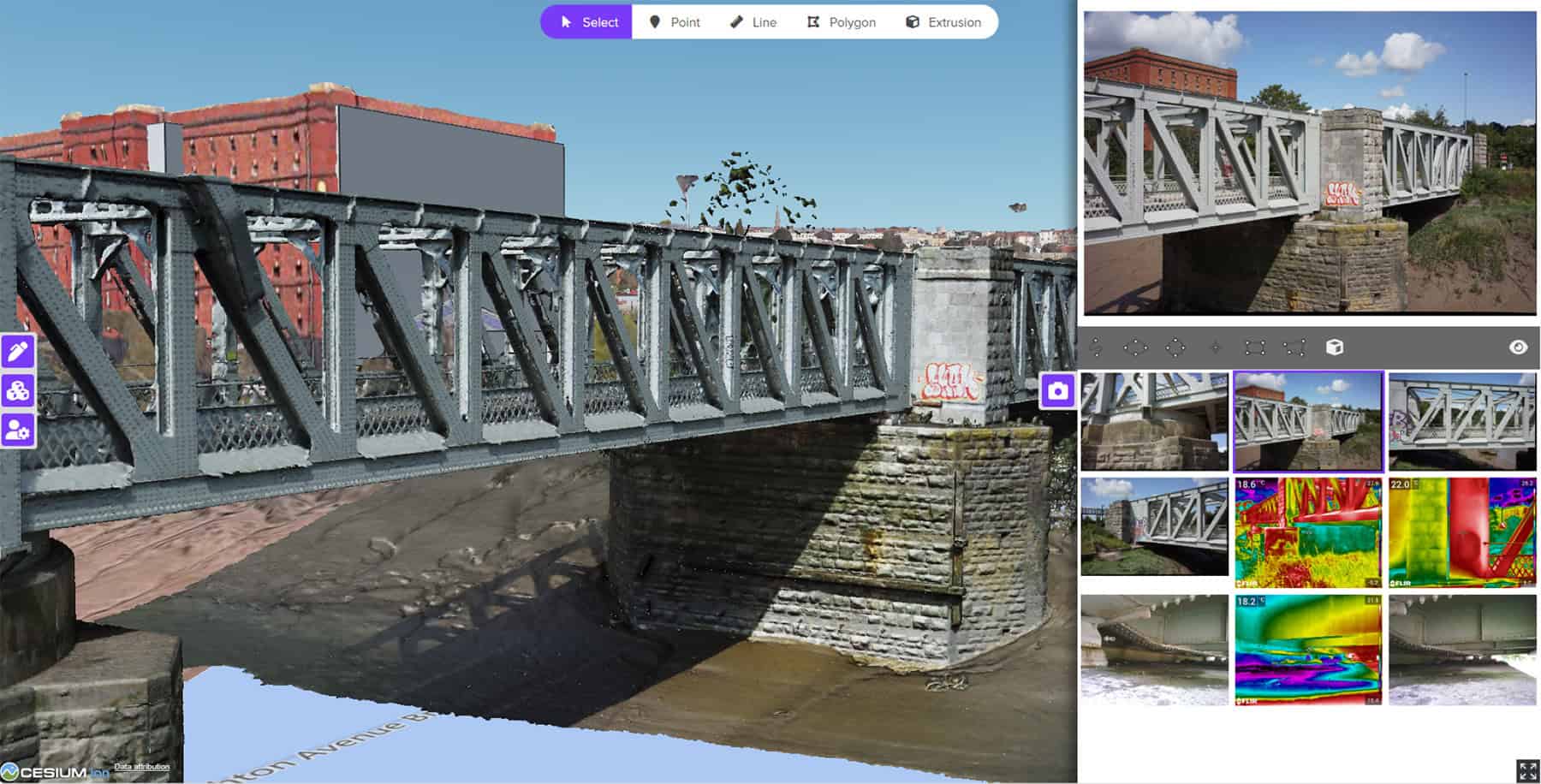
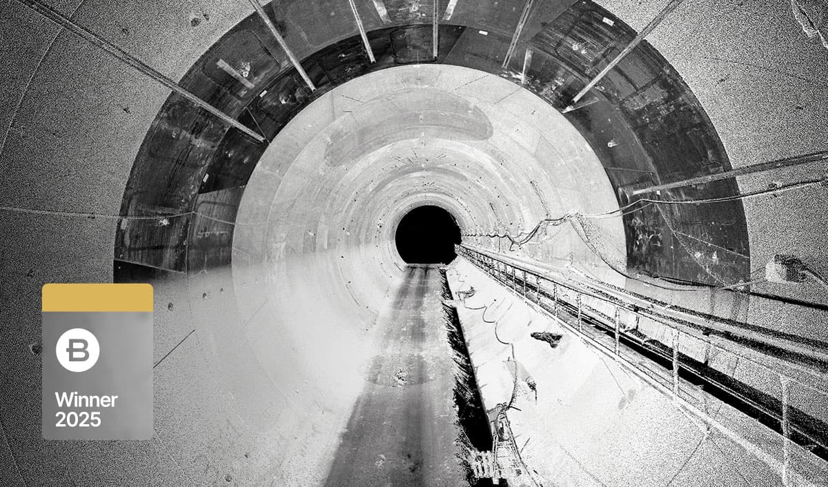
To streamline project delivery, the JKRS team chose Bentley’s integrated 3D and 4D digital solutions and workflows. From the start, they knew that keeping everyone aligned would be key. To do this, they used ProjectWise as their common data environment, which helped connect all stakeholders, from design consultants to government agencies. With everything stored in a secure, traceable platform, document control was easier, design reviews moved faster, and coordination improved across project zones. Design came next. They turned to OpenRoads Designer for geometric alignment, corridor modeling, terrain analysis, drainage design, and slope stabilization planning. This real-time collaboration meant higher-quality deliverables and a 50% boost in design efficiency. At the same time, they needed to stay in sync with external agencies. That’s where OpenCities Map came in, playing a key role in layering engineering data with cadastral and environmental datasets. Using the application made it easier to coordinate with land offices, forestry departments, and utility providers, helping the team stay ahead of potential issues. Moving to construction, the team simulated construction sequences and logistics with SYNCHRO 4D, enabling them to align plans with real-world site constraints. To monitor progress and improve transparency, they used Bentley iTwinCapture for drone-based 3D reality modeling, turning monthly site captures into photorealistic 3D models. Paired with Cesium’s web-based 3D visualization platform, these models gave stakeholders an easier way to view and manage progress.
Outcome
Bentley’s solutions played a crucial role in helping the JKRS team successfully deliver a nationally significant road in one of Malaysia’s most geographically and logistically challenging regions—all while minimizing the impact on protected areas and wildlife by 80% and reducing the project’s carbon footprint by 30%. They also unlocked major benefits, including shorter design cycles, more accurate construction plans, and stronger stakeholder engagement. By working in an integrated digital twin platform, they accelerated the design process by 50% and reduced overall project costs by 30%. On top of that, they’re exploring the use of a digital twin to manage SSLR2 throughout its lifecycle, ensuring reliable, year-round road access for years to come. In summary, Bentley’s tools not only elevated project delivery, but also set a benchmark for future infrastructure initiatives in Malaysia.
Software
OpenRoads Designer
OpenRoads Designer was used for geometric alignment, corridor modeling, terrain analysis, drainage design, and slope stabilization planning, enabling the real-time optimization of road layouts while accounting for geotechnical mountainous terrain and varying ground conditions.
Find out more about OpenRoads Designer ❯
ProjectWise
ProjectWise was used as the common data environment, making document control easier and facilitating multi-discipline collaboration and coordination across project zones.
SYNCHRO 4D
SYNCHRO 4D was used to communicate and align construction phasing with real-world site constraints, allowing the team to visualize potential conflicts and plan manpower and equipment resources more effectively.
OpenCities Map
OpenCities Map was used to support spatial planning and integration of land acquisition data, timber concession boundaries, utilities, and environmental buffers, enabling better coordination with government agencies and avoiding clashes with protected zones and existing infrastructure.
Bentley Year in Infrastructure (YII) and the Going Digital Awards is an annual event where global industry leaders come together to showcase infrastructure delivery and performance excellence and exchange visionary ideas for the future. Find out more on the YII site.