Warringah Freeway Upgrade Project
Organization: Arcadis
Project Name: Warringah Freeway upgrade
Location: Sydney, New South Wales, Australia
Project Phase: Construction
Expected Completion Date: December 31, 2026
Estimated Project Cost: AUD 1.18 billion
Bentley Software: Bentley LumenRT, iTwin Capture, iTwin Experience, MicroStation, OpenBridge, OpenRoads, PLAXIS, ProjectWise, SYNCHRO
Project
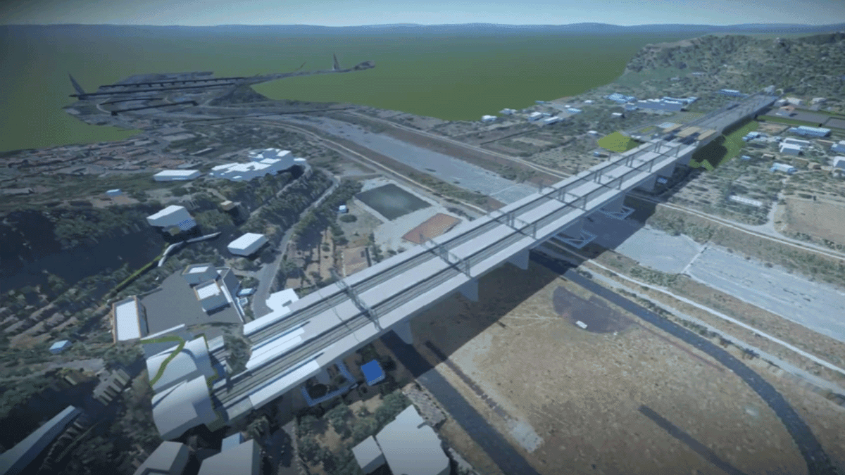
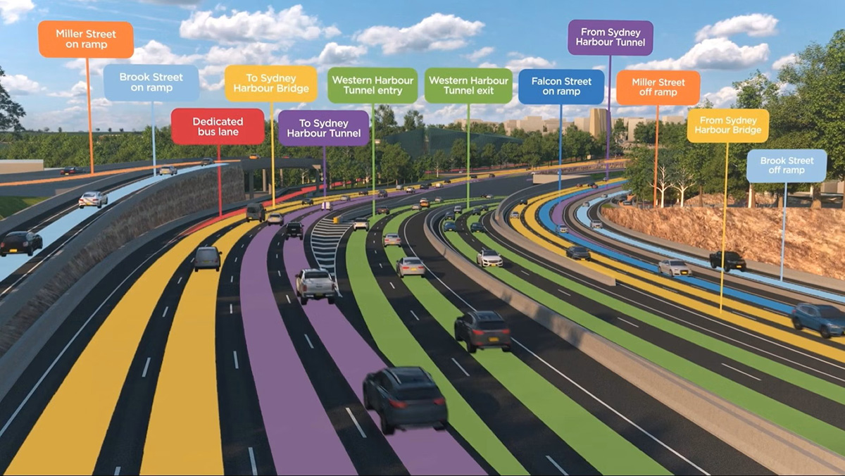
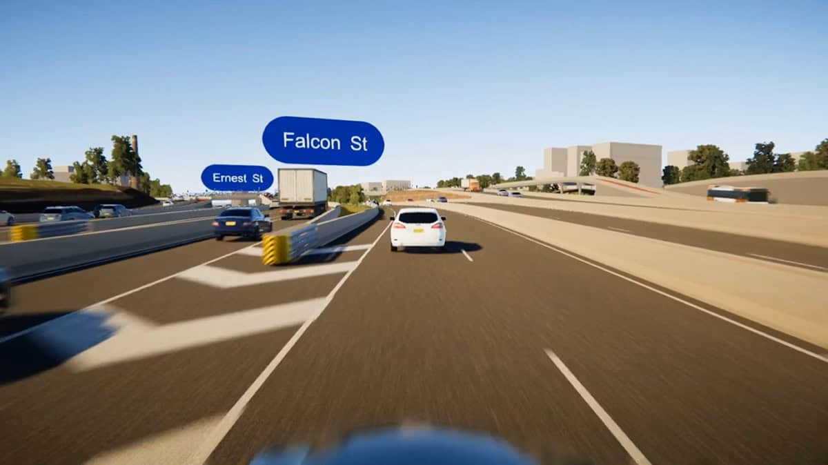
As part of the broader Western Harbour Tunnel and Beaches Link Program, the Warringah Freeway upgrade project, led by Arcadis, seeks to make one of Australia’s busiest urban freeways—traveled by over 240,000 vehicles daily—safer, more efficient, and better connected to existing and future infrastructure. The upgrade includes simplifying interchanges, improving access to the Sydney Harbour Bridge and Tunnel, adding new bus lanes, and enhancing walking and cycling paths. When finished, the Warringah Freeway will significantly reduce congestion and make travel more reliable for everyone.
But delivering this project while maintaining high network performance wasn’t easy. Located in a tight, high-traffic area surrounded by underground utilities, adjacent rail lines, local roads, and constant activity meant that there were enormous design and staging complexities. On top of that, there were existing bridges, utility relocations, and various heritage and community protections to consider. It was because of these challenges that Arcadis quickly realized that traditional 2D design methods wouldn’t cut it for the level of coordination the project required. So, they decided to adopt a more digital approach.

Facts
- The digital twin approach identified and resolved over 2,000 design clashes and saved 324,000 work hours.
- Using OpenRoads Designer for terrain modeling optimized earthworks, estimated to help avoid 450,000 tons of carbon emissions.
- Performing 4D construction staging simulations with SYNCHRO 4D accelerated the project schedule by six to eight weeks.
"Bentley’s connected digital tools have been critical in transforming the way we deliver complex infrastructure in urban environments. Through platforms like ProjectWise, iTwin, and SYNCHRO, we were able to accelerate collaboration, reduce rework, and improve sustainability outcomes on the Warringah Freeway upgrade."
Mark Shamoun, Principal Road Designer, Arcadis
Solution
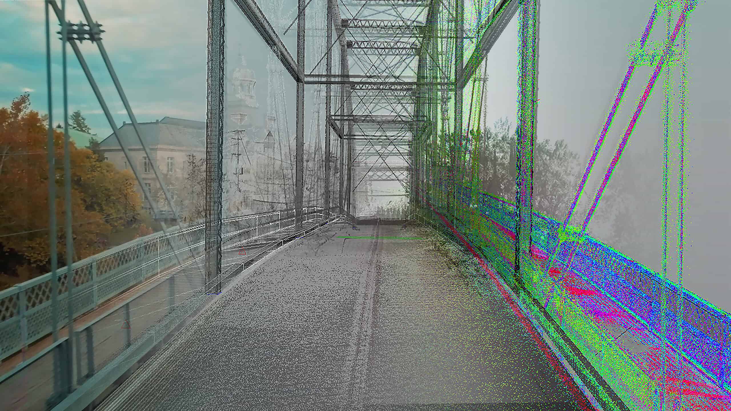
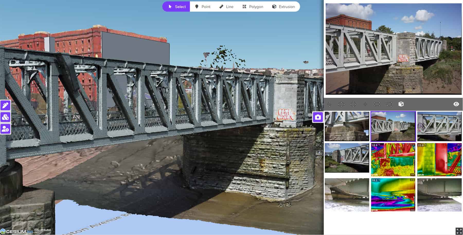
With Bentley’s connected digital ecosystem, the Arcadis team transformed the Warringah Freeway upgrade project into a fully integrated digital twin. First, they leveraged ProjectWise to establish a common data environment. This supported all file management, version control, and multidiscipline collaboration—enhancing traceability, minimizing duplication, and reducing the risk of outdated information being used throughout design and construction.
From there, they relied on Bentley iTwin platform to unify design models from OpenRoads Designer, OpenBridge Designer, and MicroStation into a real-time federated model. It allowed Transport for NSW and other stakeholders to easily access, review, and validate designs using a web-based browser, removing the need for specialized software or training. As a result, this interactive, model-driven design review process empowered the team to significantly improve engagement and decision-making.
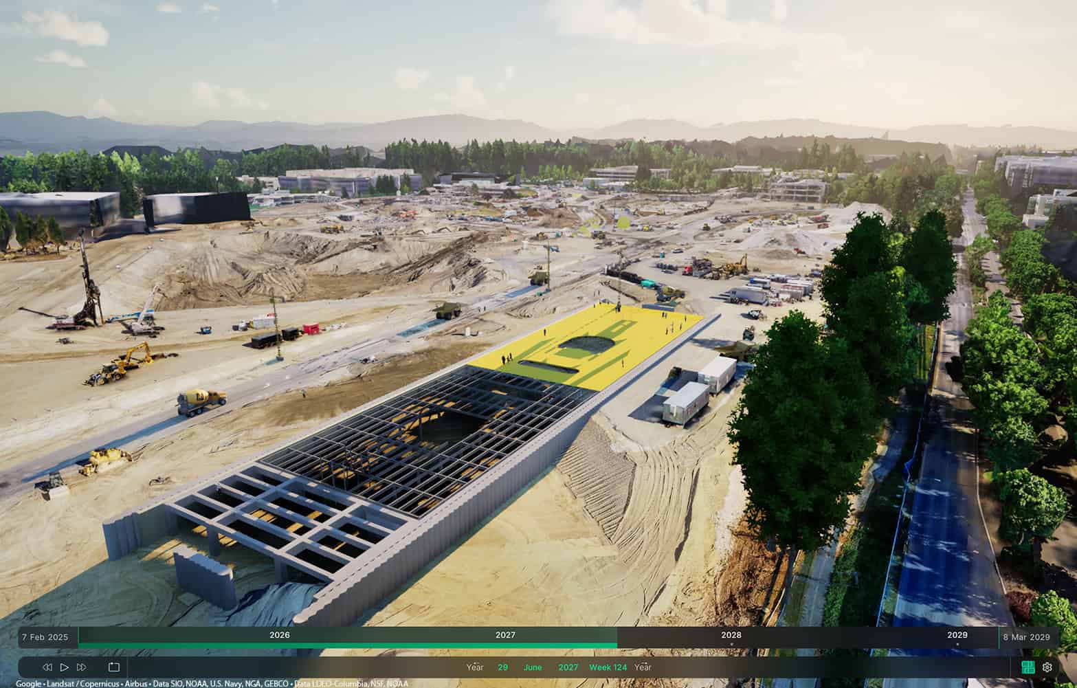
Next, the team used SYNCHRO 4D, allowing complex traffic staging across multiple work zones to be visualized and rehearsed virtually. This workflow led to earlier identification of risks and minimized disruptions to commuters. The use of SYNCHRO 4D also enabled design and construction sequencing to evolve in parallel, greatly reducing program risk and optimizing schedule resilience—all of which would have been impossible with static drawings.
Lastly, the integration of Bentley LumenRT enabled the team to develop photorealistic visualizations for public engagement and internal communication. These views were particularly valuable for visualizing the impact of noise walls, road geometry, and staging on local residents and road users, increasing transparency and reducing resistance during planning and consultation.
Outcome
By integrating all design disciplines into a single digital twin, the project team was able to identify and resolve over 2,000 design clashes and save 324,000 work hours. Using OpenRoads Designer for terrain modeling, they optimized earthworks, avoiding an estimated 450,000 tons of carbon emissions. And with SYNCHRO 4D, they were able to perform 4D construction staging simulations, accelerating the project schedule by six to eight weeks. They also improved asset integration outcomes by capturing metadata-rich models directly in the iTwin. It ensured a strong foundation for future maintenance planning and asset management, aligning with Transport for NSW’s long-term digital asset strategy.
In summary, Bentley’s solutions allowed Arcadis to successfully meet the design and staging challenges of one of Sydney’s most complex brownfield infrastructure projects—safely, efficiently, and with more transparency.
Software
ProjectWise
ProjectWise was used to create the foundation for connected data management and version control, ensuring teams worked from a single source of truth.
Bentley iTwin platform
The Bentley iTwin platform was used for real-time federation of models from different disciplines, allowing stakeholders to visualize design progress, review geometry, and validate staging scenarios collaboratively in a browser environment.
SYNCHRO 4D
SYNCHRO 4D was used to virtually rehearse and visualize complex traffic staging across multiple work zones, resulting in proactive risk mitigation and less disruptions to commuters. It also allowed design and construction sequencing to evolve simultaneously, leading to reduced risk and better schedules.
Bentley LumenRT
Bentley LumenRT was used to bring design data to life through high-quality, photorealistic visualizations used during community engagement and public consultation. They played a key role in demonstrating the impacts and benefits of proposed design changes, helping reduce public objections and ease planning approvals.
Find out more about Bentley LumenRT ❯
Bentley Year in Infrastructure (YII) and the Going Digital Awards is an annual event where global industry leaders come together to showcase infrastructure delivery and performance excellence and exchange visionary ideas for the future. Find out more on the YII site.