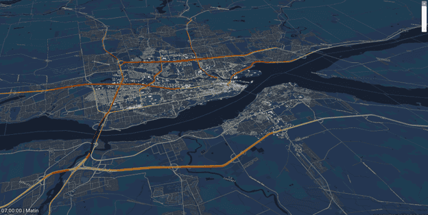
With a growing region, limited space to expand roadways, and ambitious climate goals, Québec City needs to move more people—more efficiently—without increasing congestion. That’s why the city is investing in a new, fully electric tramway: to improve reliability, expand access to jobs and services, and reduce car dependency with a main transit corridor for a more connected, multimodal network.
As Québec City prepares to launch its first 100% electric tramway, Réseau de transport de la Capitale (RTC) turned to Bentley OpenPaths™ to build a unified, data‑driven travel demand model that informs planning, supports public transparency, and empowers decision‑makers.
In this blog, we explore how RTC is using Bentley OpenPaths to transform transportation planning and deliver a next‑generation mobility network for its 569,000 residents.
Designing a Modern Multimodal Transportation Network
Québec City’s new transport vision is ambitious:
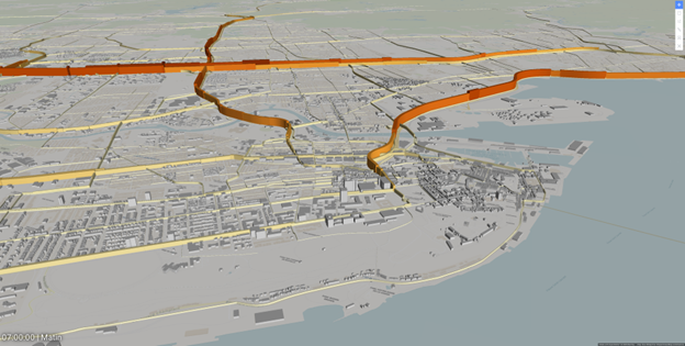
- Nearly 100 kilometers of new transit corridors
- A 100% electric tramway as the backbone
- Seamless connections across traffic, transit, cycling, and pedestrian modes
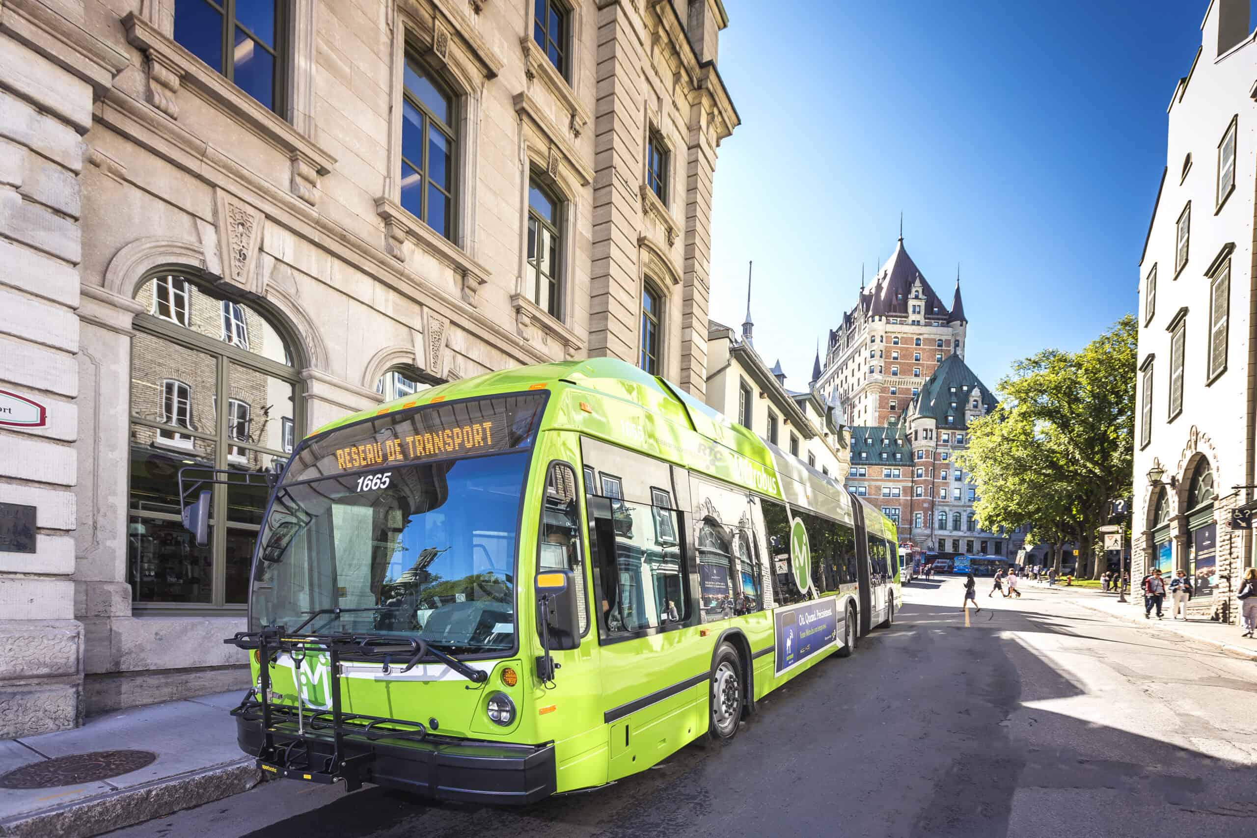
RTC also operates 61 bus lines and 75 commuter lines, forming the foundation of the region’s mobility system. With major infrastructure investments underway, the organization needed a clear, evidence‑based way to evaluate future scenarios and ensure the network meets the region’s evolving needs.
However, earlier modeling solutions could not capture the interactions between modes, which is especially critical as the city plans major transit infrastructure investments to reduce car dependency and improve transit accessibility.
Building a Unified Transportation Model with Benltey OpenPaths
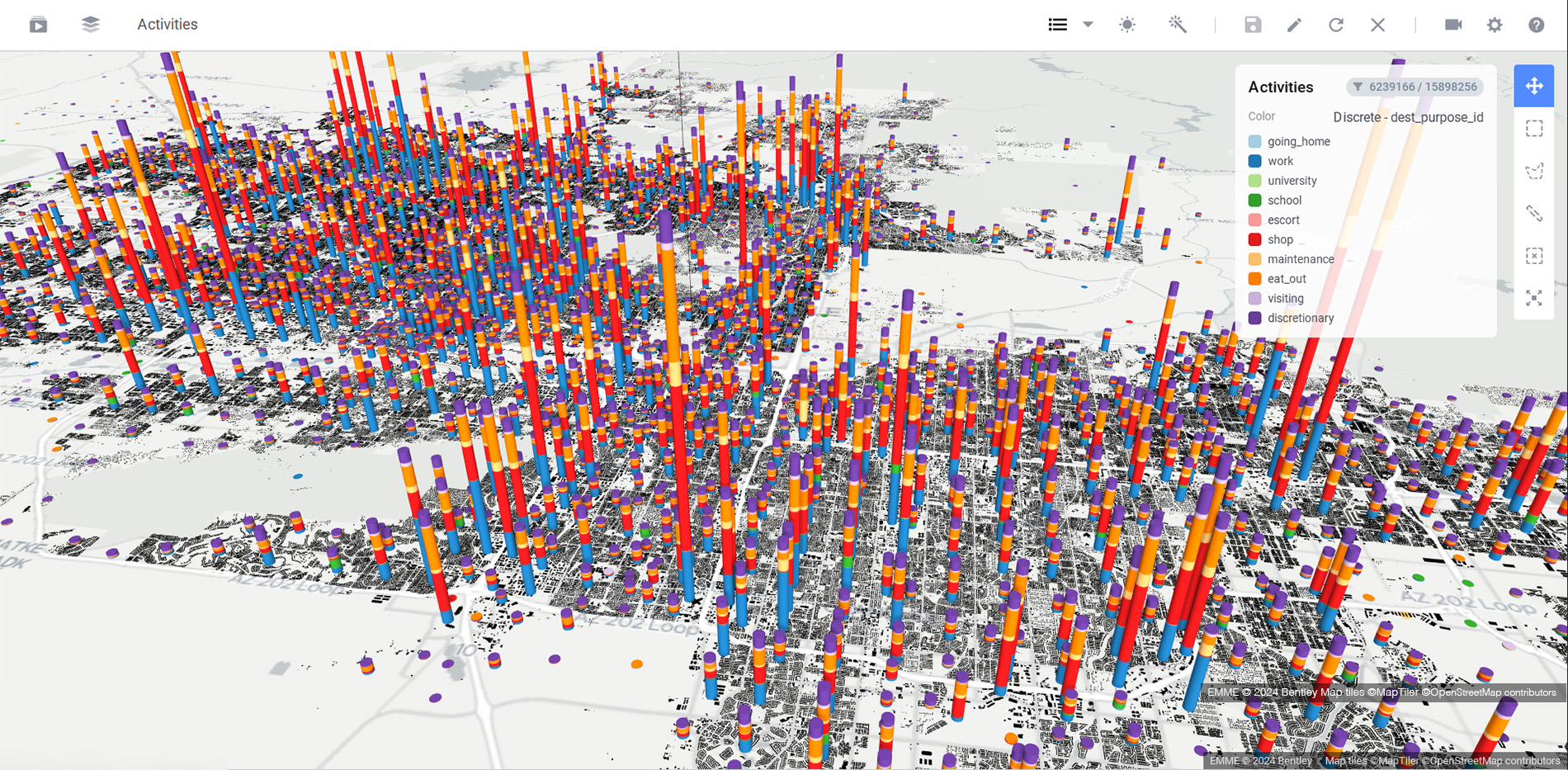
To address this challenge, RTC adopted Bentley OpenPaths EMME® and OpenPaths AGENT®, creating a single, citywide model capable of simulating the main modes of travel: drive alone, shared drive, transit, park and ride, bike, and pedestrian.
By bringing all modes into one modelling framework, RTC gained a holistic understanding of Québec City’s mobility market and could explore how the tramway would reshape ridership, travel behavior, and accessibility across the city.
The Bentley OpenPaths platform also enabled RTC to:
- Forecast modal shifts with greater confidence
- Test both operational and long‑term scenarios
- Identify traffic bottlenecks, high‑demand transit corridors, and park and ride locations
- Ensure transparent, traceable modeling for public and political stakeholders
“We really wanted to understand every part of the model to explain results with confidence,” said David Tanguay, Service Planning Analyst at RTC.
Transforming Collaboration and Public Engagement
Major infrastructure programs demand clear communication and strong stakeholder alignment. With Bentley OpenPaths, RTC can now:
- Present scenario results visually and intuitively
- Provide accessible, data‑driven insights to elected officials
- Strengthen public trust through transparent modeling
- Empower planners with a consistent and flexible model to answer “what-if” questions
- Improve coordination with consultants and partner agencies
The result is a planning process that is both rigorous and collaborative—supporting informed decision‑making at every step.
Why Bentley OpenPaths Works for Growing Cities
Just like other modern cities navigating rapid growth, Québec needed a flexible, scalable mobility modeling platform. Bentley OpenPaths offers:
- Multimodal Simulation
Integrated modeling for traffic, transit, bike, and pedestrian flows. - Data Transparency
A unified, accessible environment that builds stakeholder confidence. - Scenario Flexibility
From network redesign to service adjustments, planners can quickly test “what‑if” questions. - Evidence‑Based Planning
Supports ridership forecasts, operational strategies, and long‑term investment decisions. - Future‑Proof Resilience
Helps cities transition toward low‑carbon, multimodal mobility systems.
The Impact: A More Sustainable, Accessible Québec City
By using Bentley OpenPaths, RTC can better anticipate how the electric tramway will influence the region’s travel patterns, reduce car dependency, and enhance the efficiency of existing transit services.
The new modeling framework is now a cornerstone for:
- Sustainable urban integration
- Better transit accessibility and network connectivity
- Long‑term infrastructure investment planning
Québec City is advancing its long-term mobility plans with rigorous modeling to support informed, transparent decision-making.
Shaping the Future of Mobility
Modern cities need reliable, flexible tools to plan transportation systems that meet tomorrow’s demands. With Bentley OpenPaths, RTC is building a stronger, more sustainable mobility future, one that benefits residents, businesses, and the region for decades to come.
See how Bentley OpenPaths transportation planning software helps agencies model multimodal networks, test scenarios, and support smarter long-term mobility decisions.