From Environmental Science to Geospatial Leadership: My Map-tastic Adventure
In a world where the landscape of our cities and environments is constantly evolving, the role of geospatial technology is essential. It is the invisible thread that weaves together the fabric of our urban and natural worlds, providing clarity, connection, and insight. As we stand at the intersection of innovation and tradition, the importance of our collective efforts in the geospatial community cannot be overstated.
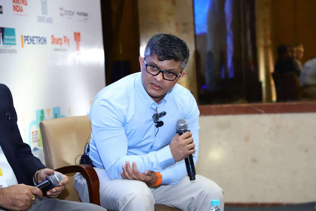
For those who may not know me, I’ve been with Bentley for over 15 years, currently serving as an industry strategist. My focus is on leading geospatial and digital twin capabilities within our user community. I also have the privilege of co-chairing the Digital Twin Working Group at the Open Geospatial Consortium, and my latest role is president of the World Geospatial Consortium (WGIC).
WGIC: Leading with Community and Global Impact
WGIC has long been a source of inspiration for me, because it’s more than just an organization—it’s a global catalyst. With over 50 member organizations, including founding members Esri and Autodesk, across more than 20 countries, WGIC unites the geospatial industry to tackle some of the world’s most pressing challenges—from climate resilience and urban transformation to data policy and workforce development.
What makes WGIC truly special is its community. It is a place where competition gives way to collaboration, and where bold ideas evolve into shared action. It’s about people. It’s about a shared belief that geospatial knowledge can bring clarity, connection, and better decision-making to a world facing complex challenges.
Leading WGIC: A New Chapter Begins
My journey with WGIC began three years ago. WGIC partners with the Global Covenant of Mayors, and I also served as a co-chair for OGC Open, which deals with data standards. I co-chaired the digital twin working group, where we worked with other geospatial vendors to formulate an industry view of digital twins. We use technology standards as a means of validating what the client is seeking, filling the void between government and technical standards. This is a crucial place for us to influence and say where we want to be.
As I step into the role of president, I do so with immense gratitude—to the WGIC community for their trust, and to Bentley for their unwavering support. Bentley continues to lead at the intersection of infrastructure and geospatial innovation, empowering cities, nations, and industries in going digital, staying resilient, and planning with precision.
WGIC’s impact is growing—and it’s never been more needed. In a time when geospatial is becoming the next utility, I’m inspired by our collective commitment to policy, partnerships, and people.
WGIC has achieved significant milestones over the years. WGIC participated in key global events, including COP27, GEO WEEK, INTERGEO, and UN-GGIM, experiencing substantial growth in membership and gaining global recognition. WGIC received the Prince Talal International Prize for Human Development at COP27 for its project, “Leveraging Commercial Geospatial Capabilities for Climate Action in Africa.” This project highlights the value of geospatial technologies in advancing climate action and building long-lasting partnerships with philanthropic organizations.
Geospatial + Infrastructure: Aligning Policy and Technology
The timing is perfect for me to become president of WGIC. The synergy between WGIC and Bentley lies in their complementary strengths: WGIC’s global policy influence and Bentley’s mission in advancing infrastructure. It presents a unique opportunity to support the geospatial sector. Bentley’s acquisition of Cesium and integration with the iTwin Platform creates a foundational ecosystem for digital twins—merging engineering precision with real-world geospatial context. This directly supports WGIC’s mission to position geospatial technologies as core infrastructure for climate resilience, urban innovation, and sustainable development.
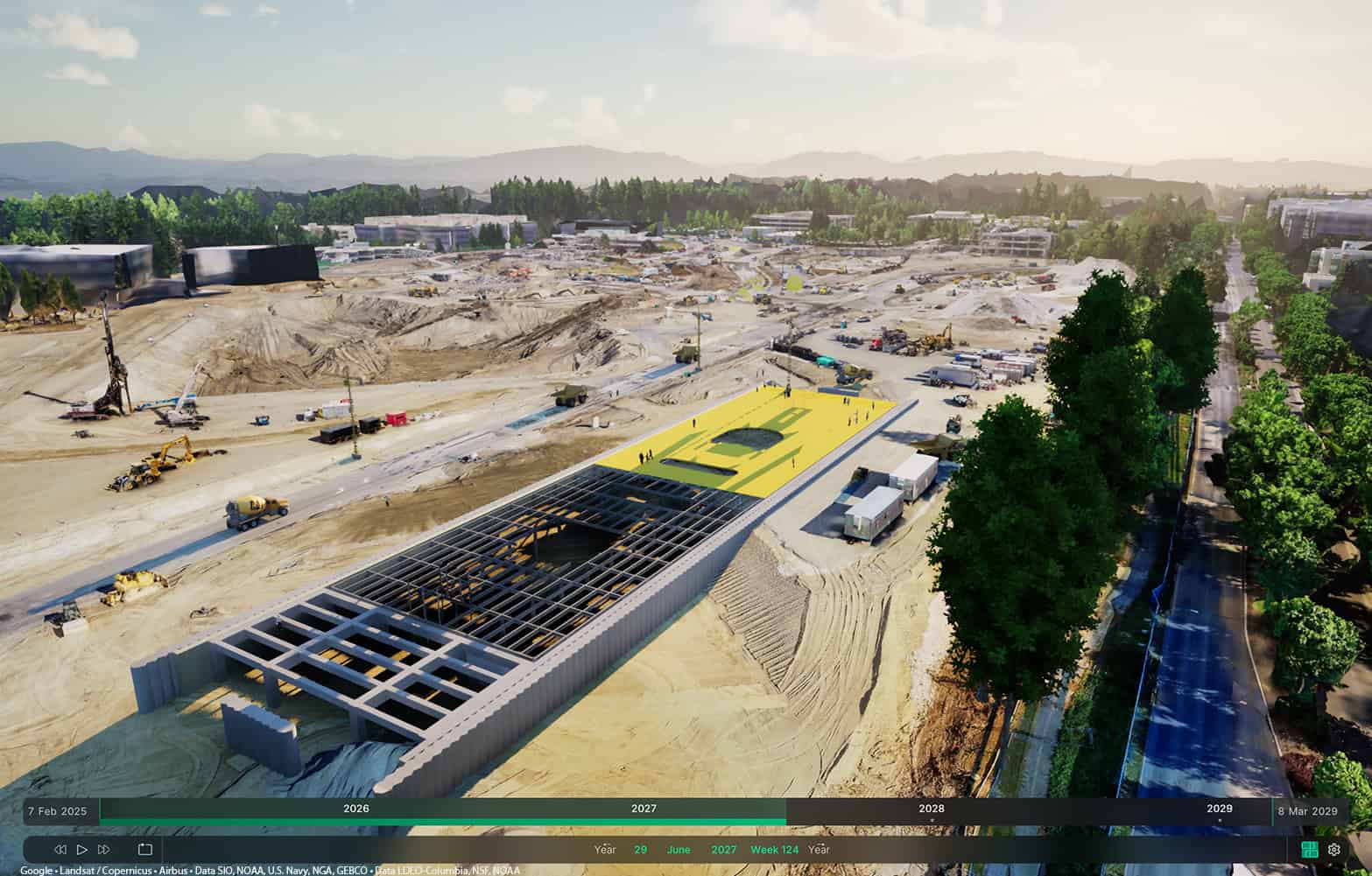
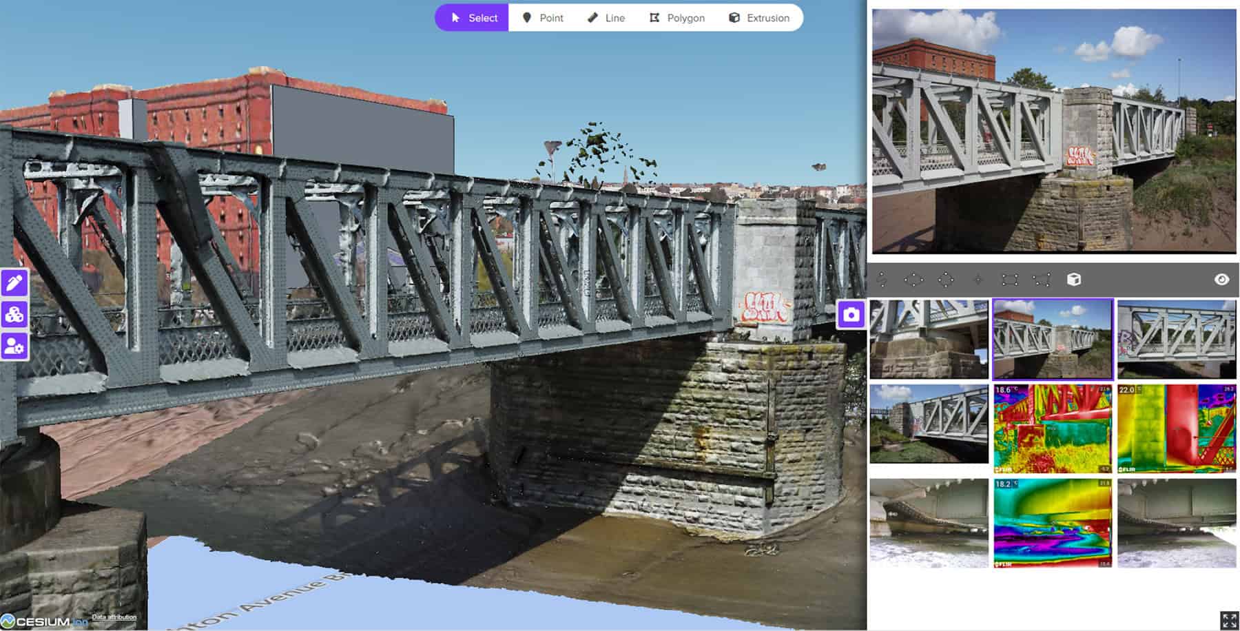
The shift from 2D to 3D geospatial data is irreversible, driven by the demand for millimeter-accurate digital twins in construction and utilities. Both organizations share a commitment to inclusiveness and open standards through partnership with OGC and BuildingSmart, such as 3D Tiles, IFC, and CityGML, enabling scalable and interoperable solutions. For example, powered by Cesium, Bentley is helping Dublin create a digital twin for emergency response. WGIC can amplify such outcomes globally through initiatives like climate action and city climate solutions, achieved through its partnership with the Global Covenant of Mayors (GCoM), the largest global alliance for city climate leadership. This partnership enhances city governments’ climate action capabilities by integrating geospatial data and solutions into climate action planning. The initiative supports over 13,000 cities worldwide, helping them leverage geospatial tools for adaption, emission monitoring, and resilience planning.
As AI permeates geospatial workflows, WGIC’s policy expertise can guide the industry, supported by Bentley and other WGIC members in the development of transparent AI tools. For example, together with other partners, such as OGC or buildingSMART, we can co-author guidelines for AI in geospatial analytics.
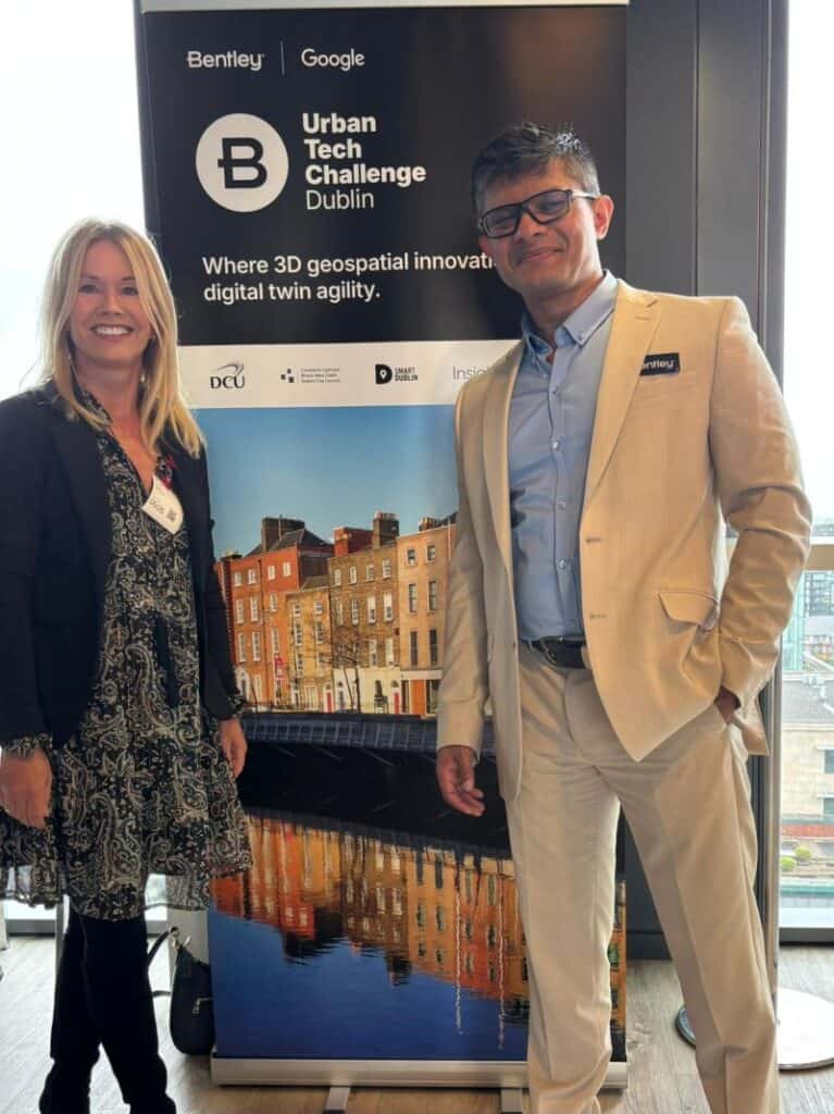
The Urban Tech Challenge, held at Dublin in May 2025, is another great example which demonstrates that geospatial capabilities is evolving into a core urban utility. The challenge was organized by Bentley and partnered by Dublin City, Dublin City University, and Google. It brought together top innovators, subject matter experts, data analysts, and UX designers to address urban infrastructure issues (e.g. urban planning, mobility, and flood management). Within just two days, 11 different smart city solutions were prototyped with 3D geospatial technologies and real-time data integration from Google, including BIM, GIS, and open data from Dublin City.
Reflecting on My Career: Lessons Learned and Future Goals
Reflecting on my career, I began with undergraduate work in environmental sciences. I enjoyed the sustainability aspect and practical learning, especially in GIS and remote sensing. My master’s in GIS involved working with the Natural Resource Institute, where we used technology to identify future famine areas. This practical experience led me to Transport for London as a technical advisor, translating between the technical side and the client side, which became my superpower. I have maintained capability as I gained more experience and skills. For example, when I gained qualifications as an Oracle database administrator, I combined my facilitation skills with my technical knowledge to explain to clients how they could reach their goals, making me more consultancy-oriented.
From Transport for London, I moved to EXOR, which was acquired by Bentley. I started in transportation, then utilities operations asset management, and later utilities design. This shift required learning new technology from the ground up, but I prioritized understanding what the customer is seeking. I then moved to power, water, and now cities. I love the variety of my job at Bentley, discovering myself every few years and pushing myself outside my comfort zone. It’s about transforming while performing, understanding the industry, and creating success for the Industry, Bentley and the user.