How advanced mapping technologies are shaping the future
In the modern era, incorporating digital solutions from the earliest stages of complex or large-scale energy programs is crucial. Embracing a digital-by-default approach ensures precision, efficiency, and adaptability, ultimately leading to successful and sustainable energy infrastructure projects. This article blog delves into the transformative role of geospatial solutions in energy asset development, highlighting their benefits in planning, construction, and maintenance.
Geospatial mapping solutions: Helping build tomorrow’s energy assets
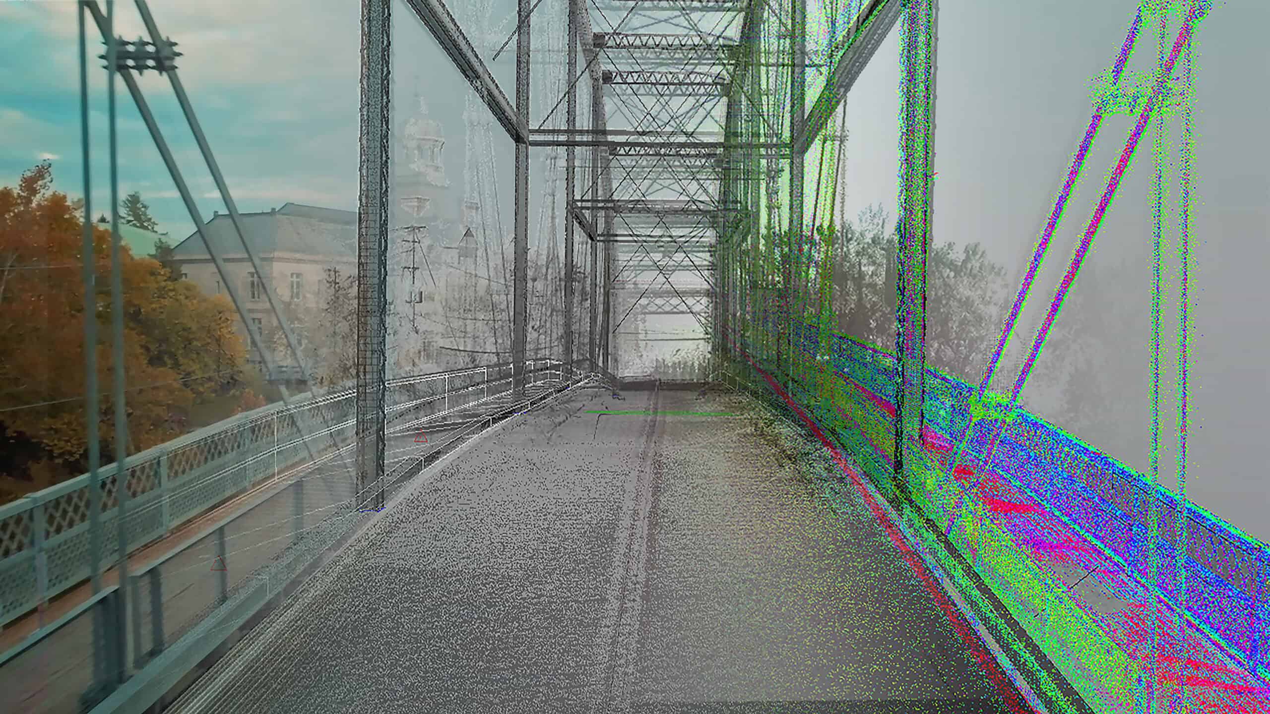
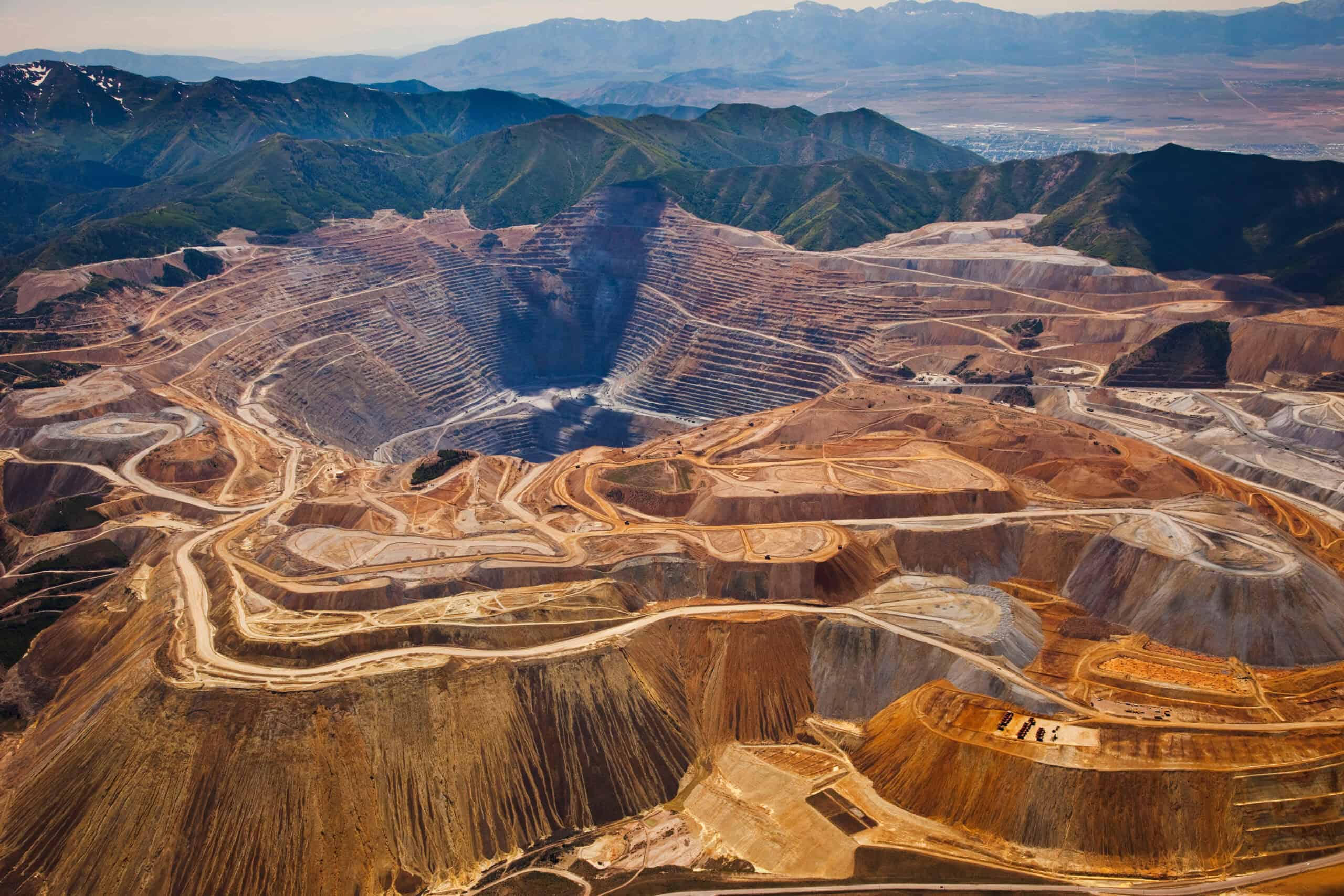
One of the greatest challenges in energy infrastructure development is translating conceptual plans into physical structures. Traditional surveying methods, while effective in the past, often fell short when it came to dealing with complex or large-scale projects. They required manual measurements and often involved significant room for human error. However, the advent of precision mapping has revolutionized this process, bringing a new level of accuracy and efficiency to energy projects, whether oil and gas, power generation, or renewables.
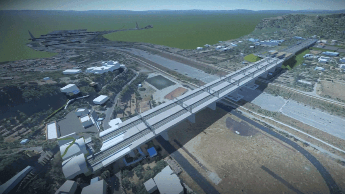
Geospatial solutions play a pivotal role in this shift. During the planning phase, these systems provide accurate geospatial data that allow engineers to create detailed maps and models of the project site. This data can be integrated with design software to produce 3D models, offering a realistic view of how the infrastructure will fit into the existing landscape. Combining the technologies is particularly beneficial for projects involving challenging terrains, such as solar plants on remote hillsides, or hydropower projects in complex valleys.
Once construction begins, geospatial solutions continue to prove their worth. They guide construction machinery, ensuring that earthmoving equipment, cranes, and other heavy machinery operate with precision. Automated systems can follow preset paths with minimal deviation, which is especially useful in tasks like laying energy asset foundations or constructing access roads where alignment is critical. The accuracy of geospatial data helps reduce the need for rework, saving time and money and keeping projects on track.
Additionally, geospatial solutions enhance collaboration among project stakeholders. Engineers, architects, and construction crews can access the same accurate data, improving communication and coordination. This shared perspective minimizes misunderstandings and ensures that everyone is working towards the same objectives, ultimately leading to smoother and more efficient energy project execution.
Constructing robust energy infrastructure through data-driven insights
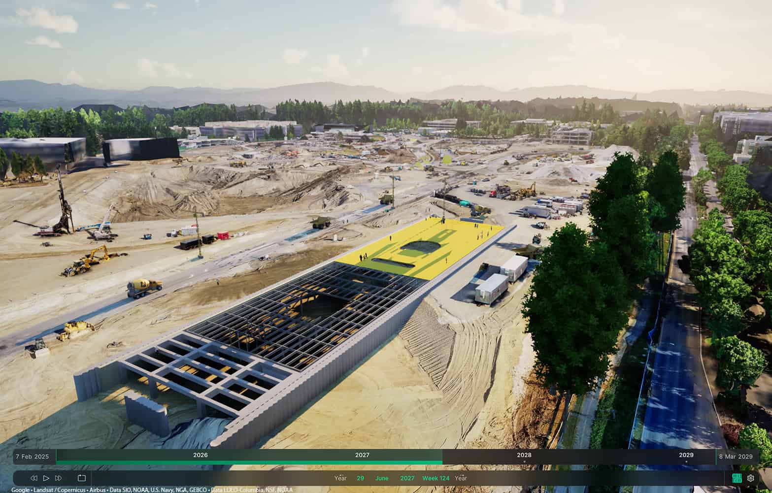
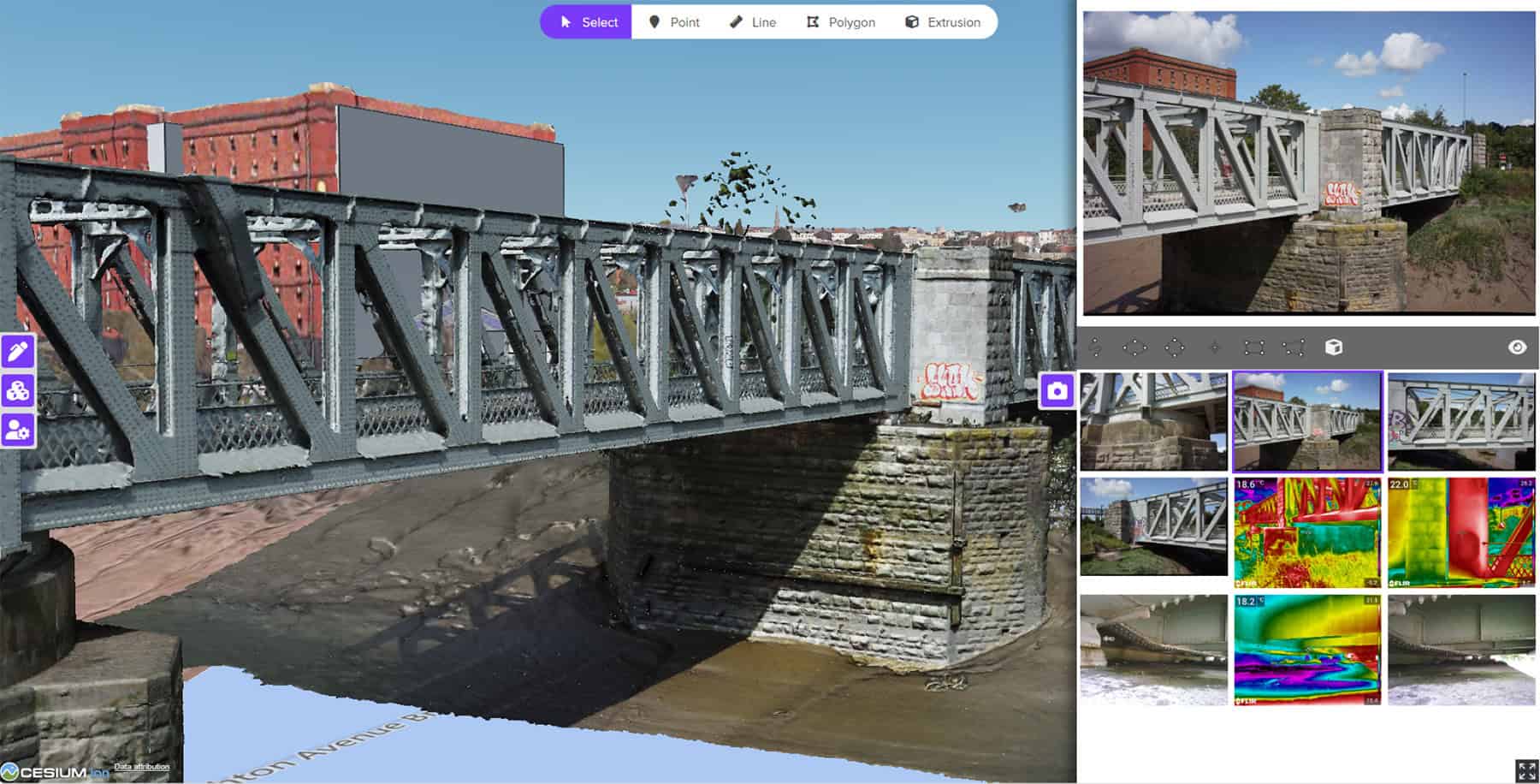
Energy infrastructure projects are not just about construction. They are about creating assets that will serve communities for decades, if not centuries. This longevity requires careful planning and a deep understanding of both the built and natural environments. Geospatial solutions provide critical insights that help planners design resilient energy infrastructure capable of withstanding environmental and human-made challenges. Whilste geospatial technology has been around for many decades, in recent years advancements have made it more powerful, accessible, and valuable. For example, 3D Tiles, from Cesium, allow fast streaming, visualization, and interaction with massive 3D geospatial datasets, for rapid navigation of environments where energy infrastructure is situated. Incorporating geospatial data into digital twins, made with platforms such as Bentley’s iTwin, provide context around complete energy assets, improving widespread understanding of those assets. And the incorporation of detailed geospatial data in energy infrastructure design tools, such as MicroStation, improves design accuracy and reduces the risk of downstream issues.
One of the most significant advantages of geospatial solutions is their ability to simulate real-world conditions. By integrating geospatial data with environmental models, engineers can predict how infrastructure will perform under various scenarios. For example, when developing a geothermal energy plant, environmental models can show how flooding might affect subsurface water flows and geothermal reservoirs or potentially contaminate nearby water bodies with geothermal fluids. Also, they can provide seismic data which helps with the design of wind turbines that are more resistant to earthquakes. These insights allow for proactive planning and the integration of safety features that protect both infrastructure and the people who rely on it and ensure the risk of power outages are reduced.
Geospatial solutions also contribute to environmental sustainability. When planning new developments, geospatial data can identify environmentally sensitive areas, such as wetlands or wildlife habitats. This information helps engineers design energy projects that minimize ecological disruption, align with regulatory requirements, and promote sustainability.
Beyond the construction phase, geospatial solutions continue to add value by supporting maintenance and management efforts. Infrastructure requires ongoing care, and geospatial technology can greatly assist this too. For example, it can be used to monitor the condition of power lines, including factors such as vegetation encroachment, assess weather patterns to aid in operational risk assessment, and provide data on access routes for maintenance and repair engineers. This proactive approach allows operators to identify potential issues early and carry out maintenance before minor problems escalate into major failures. In this way, geospatial solutions not only support the construction of new energy infrastructure but also extend the lifespan of existing assets.
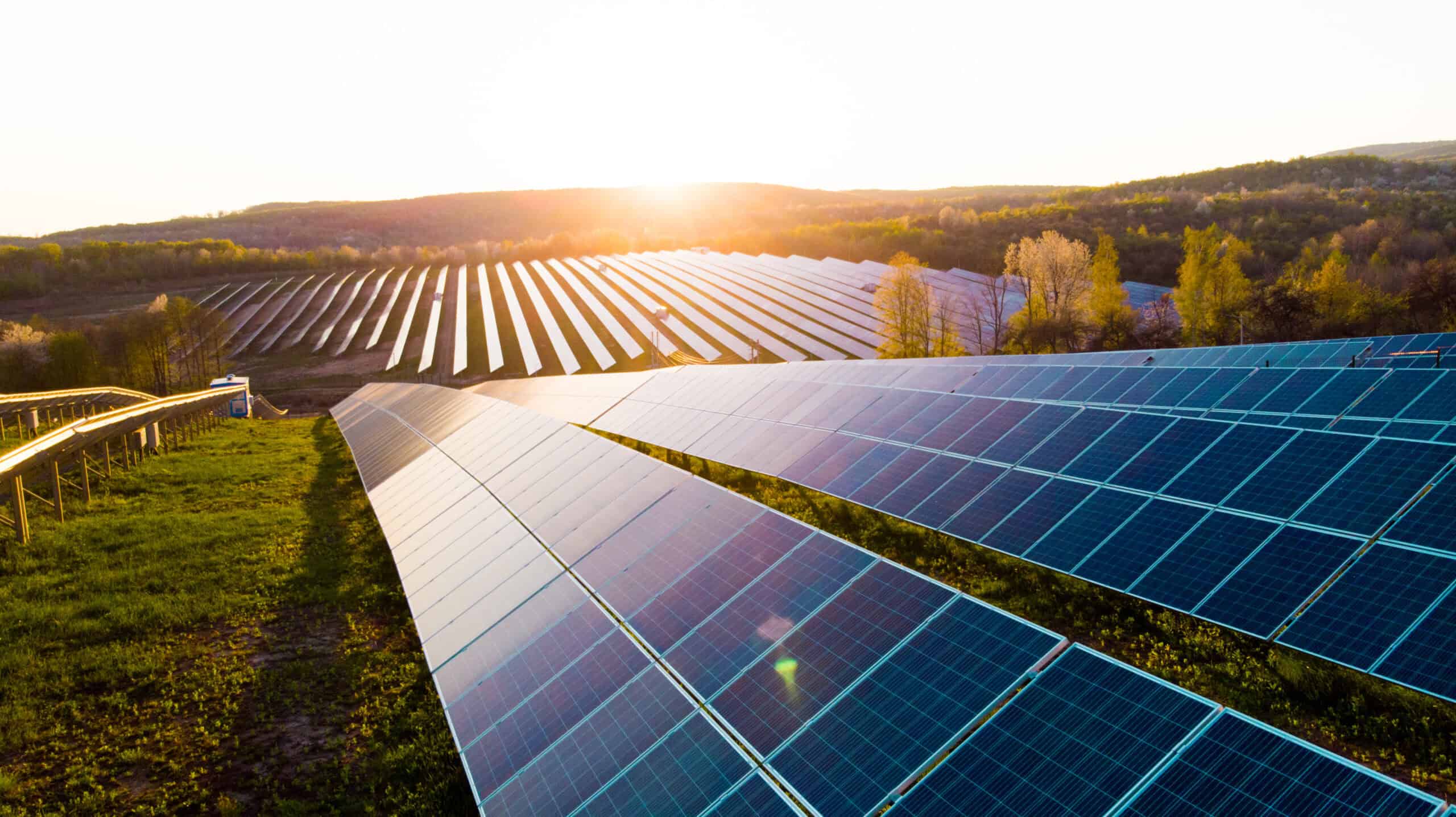
A prime example of the application of geospatial data in energy infrastructure development is in China. Engineering organisation PowerChina Hubei was tasked with installing nearly 15,000 solar panels in undulating terrain, dominated by hills, forests, and ponds. The process was complex, with each panel needing to be sited individually to optimise their efficiency, considering the terrain at the location of each one. Implementing a digital twin containing geospatial data, representing the exact landscape of the area, along with asset design data, gave them a better understanding the natural environment of each panel location. This insight allowed them to deliver an innovative project which maximised the production of the solar plant.
What’s next: AI, DERs, and the expanding role of geospatial in energy
The benefits of geospatial solutions extend beyond individual projects, influencing broader trends in energy infrastructure development. For example, the move towards Distributed Energy Resources (DERs) will be aided greatly by this technology. Geospatial solutions will, firstly, be able to help site DER assets in optimal locations for performance and cost- efficiency, considering factors such as solar irradiance, wind speed, land use, and proximity to substations. They will also help utilities and operators understand where existing DER assets are located and connected, through a real-time, map-based view of all DERs across a region, which will benefit field crews in maintenance and repair activities. They will also support DER output forecasting, based on weather and environmental conditions, assisting in demand response planning.
As technology continues to advance, new opportunities for geospatial solutions are emerging. The integration of artificial intelligence (AI) and machine learning (ML) with geospatial data promises to enhance predictive analytics, helping infrastructure planners anticipate challenges before they arise. Drones equipped with geospatial solutions offer the potential to automate surveying tasks, collecting data from hard-to-reach areas, such as remotely located wind farms, without risking human safety. These innovations not only improve accuracy and efficiency but also expand the possibilities of what energy infrastructure projects can achieve.
Why accuracy in energy infrastructure starts with geospatial data
Energy infrastructure is more than concrete and steel. It is fundamental to so many aspects of our lives. As the energy transition gathers pace, the need for precise, efficient, and sustainable infrastructure development grows. Advanced geospatial solutions are at the forefront of this transformation, offering a reliable path from concept to completion.
By integrating real-time geospatial data into planning and construction processes, geospatial solutions enhance accuracy, improve safety, and support environmental sustainability. They allow engineers to build energy assets that are not only resilient to current challenges, but also adaptable to future needs. As we look ahead, embracing geospatial solutions will be critical to creating a dependable energy ecosystem that truly serves communities—efficiently, responsibly, and innovatively.
Ready to build smarter, more precise and resilient energy infrastructure? Find out more about –Bentley in the Energy sector
.