This week, we explore how generative AI and virtual models are reshaping efforts to protect our planet and its history. From predicting catastrophic flooding and reviving coral reefs to preserving ancient cultural sites, AI and digital twins are even preparing humanity for its next “giant leap.”
There will be flood
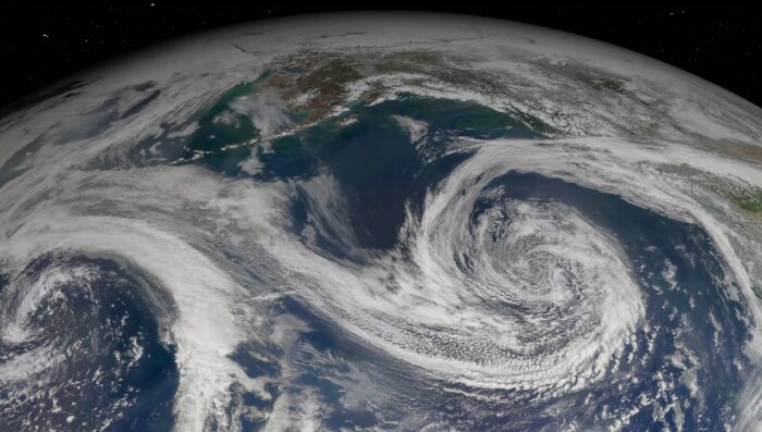 A satellite image of Earth showing swirling cloud patterns forming a hurricane.
What is it? MIT scientists are using generative AI to create satellite images that predict potential flooding from a hurricane before it happens. “The method combines a generative artificial intelligence model with a physics-based flood model to create realistic, bird’s-eye-view images of a region, showing where flooding is likely to occur given the strength of an oncoming storm,” the school explained in a news release. Incorporating a physics-based model helps prevent the AI from “hallucinating” and predicting floods in areas where they cannot occur.
Why does it matter? MIT tested the model by recreating the 2017 flooding in the Houston area caused by Hurricane Harvey, demonstrating it as a proof-of-concept. “In order to apply the method to other regions and depict flooding from future storms, it will need to be trained on many more satellite images to learn how flooding would look in other regions,” the university stated. “Providing a hyper-local perspective of climate seems to be the most effective way to communicate our scientific results,” says MIT professor Dava Newman, the study’s senior author. “People relate to their own ZIP code, their local environment where their family and friends live. Providing local climate simulations becomes intuitive, personal, and relatable.”
The Benefits of Adaptation Economy
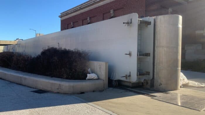 Arcadis, the global engineering firm, has designed floodgates for Manhattan’s waterfront.
What is it? As extreme weather events become more frequent, the urgent economic and social need for climate adaptation increases—particularly in developing markets most vulnerable to the changing climate, according to new research from Standard Chartered. The international bank estimates that every dollar spent on adaptation will yield a whopping $12 in economic benefit, especially in high-risk regions like Bangladesh, Egypt and Indonesia. Nevertheless, only 0.4% of surveyed investor capital is spent on adaptation projects in these critical markets.
Why does it matter? Investing in climate adaptation is essential for protecting infrastructure and economic stability where risks are highest. Adaptation-focused infrastructure—such as flood defenses, climate-resilient buildings and early warning systems—can secure supply chains, promote long-term growth and reduce costly climate-related damage in the future. Standard Chartered and other financial leaders emphasize that with greater public-private collaboration to unlock funding, the “adaptation economy” offers a transformative opportunity to build resilience on a global scale.
Moon Operators: Cesium Powers Realistic Lunar Training
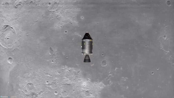 The Command Module Columbia looking down at the Apollo 11 landing site. Courtesy Petri Wilhelmsen.
What is it? Cesium has combined immersive gaming with advanced aerospace training in “Reentry – A Space Flight Simulator,” which offers users a realistic journey through NASA’s Mercury, Gemini and Apollo missions. Reentry will also incorporate Cesium Moon Terrain, an accurate, high-resolution 3D digital twin of the Moon’s surface, allowing users to simulate lunar landings, orbits and even handling emergencies with precision. Cesium’s digital Moon model brings unmatched detail, from craters to surface textures, creating an authentic lunar environment.
Why does it matter? Cesium is now part of Bentley, and its digital twin technology can support infrastructure planning that’s literally out of this world, like lunar mission planning, construction and exploration. For aerospace professionals, Cesium Moon Terrain enables detailed mission rehearsals and planning simulations, providing essential practice for navigating the complexities of lunar terrain. This highly accurate digital model of the Moon exemplifies how digital twins can transform training, preparing the next generation of space explorers with lifelike simulations and a grounded understanding of where they’re headed.
Monitoring Coral Reefs with Digital Twins
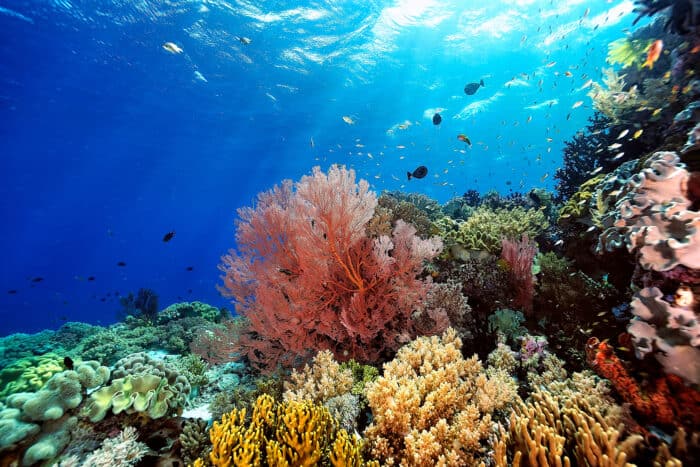 Marine biologists at 17 sites across Indonesia are using 3D digital twins to monitor coral reefs.
What is it? Coral reef preservation is undergoing a digital revolution. Marine biologists at 17 sites across Indonesia are using 3D digital twins to monitor coral reefs with remarkable speed and precision. By stitching together thousands of high-resolution photos with photogrammetry, researchers can create detailed reef models to help them assess coral growth and structural complexity down to the smallest detail. Teams used this technology to evaluate the Mars Coral Reef Restoration project, the largest in the world, showing that restoration efforts can revive the intricate structure of reefs across wide areas.
Why does it matter? Digital twins of coral reefs are transforming how we conserve and restore these vital ecosystems. By providing precise and replicable data, 3D modeling enables scientists to track even tiny changes over time, guiding efforts to more efficiently revive reefs. As photogrammetry becomes cheaper and more accessible, it could transform environmental monitoring on a wider scale, illustrating the critical role of digital modeling in ecological restoration.
Preserving Europe’s Past with Digital Archaeology
What is it? Across Europe, digital technology is transforming how we record our cultural heritage. Archaeologists are using drones, 3D scanning and photogrammetry to create highly detailed digital models of ancient sites—including one of Europe’s key prehistoric sites, Serbia’s Vinča settlement—before they risk being lost to urbanization or environmental degradation. These models also allow researchers to remotely study the structural and historical details of these sites.
Why does it matter? Digital archaeology provides a sustainable way to preserve the world’s archaeological and cultural legacy for future generations. By enabling researchers to assess and monitor heritage sites with precision, digital models can also provide global educational access to the world’s precious historical sites. Digital modeling can extend below ground, too. For example, Bentley-owned Seequent, a leader in subsurface imaging, has used digital twin technology to model Paris’s underground geothermal aquifers, which supply clean energy to 250,000 homes—showing how digital tools can tap into both historical and natural resources.

