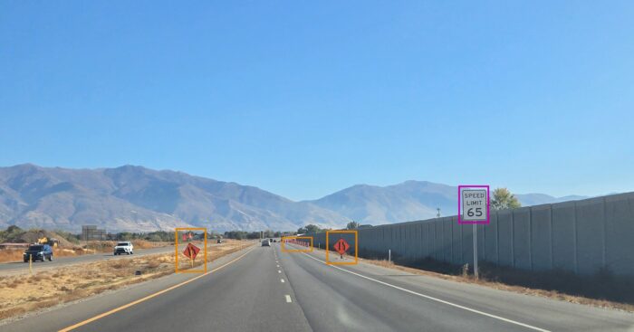
 Blyncsy’s technology can be used to detect over 40 different road conditions and asset inventory issues.
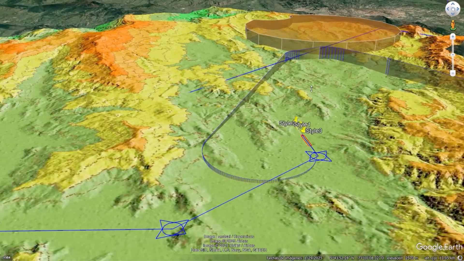
When Bentley Systems, the infrastructure engineering software company, acquired Blyncsy, which applies AI to crowdsourced imagery for automated roadway asset detection and inventory, in 2023, it aimed to disrupt the tedious process of municipal roadway inspection. Integrating Google Maps’ robust imagery and data into Blyncsy establishes a comprehensive baseline for proactive management of everything from potholes and cracks in pavement to more serious infrastructure risks caused by disasters.
“Google has a kind of architecture, a framework, a pipeline—a system to optimize AI models on their cloud infrastructure,” explains Mark Pittman, Bentley’s director of infrastructure AI and the founder of Blyncsy. “That’s really what we’re taking advantage of.”
Before Blyncsy, departments of transportation and other agencies would spend months gathering detailed 360-degree imagery of roads and infrastructure. The work cost up to $300 per mile and required five months for data processing. Blyncsy slashes both. “We’ve been able to take that same information to market at half the cost and deliver it in 98% less time,” Pittman says. “Why? Because [the data has] already been collected. And now, with Google, we have access to exponentially more infrastructure information.”
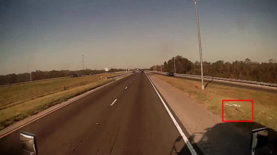
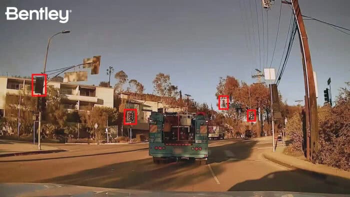 Malfunctioning streetlights are detected by Bentley’s Blyncsy technology in crowdsourced dash cameras in the Los Angeles area after wildfires caused major damage to critical safety infrastructure.
While disaster recovery is a prime opportunity for this technology, Blyncsy helps with day-to-day transportation challenges as well. Google’s historical imagery combined with Blyncsy’s analytics enables users to detect infrastructure issues—like deteriorating pavement or fading road markings—long before they escalate into costly problems.
“Cities can now monitor infrastructure conditions continuously, accurately forecasting maintenance needs and prioritizing repairs based on real, data-driven insights,” Pittman says. This proactive approach not only extends the life of infrastructure but also helps municipalities plan budgets and allocate resources more effectively.
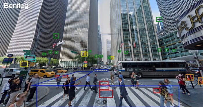 Bentley’s Blyncsy technology can be used with Google Street View imagery to detect roadway issues and assets, from potholes and crosswalk paint condition to street signs and traffic lights.
The synergy between Bentley and Google is further amplified by Google’s Vertex AI, a fully managed AI platform powered by Google’s Gemini models. Vertex AI offers developers tools like Vertex AI Studio and Agent Builder to deploy advanced capabilities at scale.
“Through our partnership, we are leveraging Vertex AI to innovate faster,” Pittman says. “Google’s infrastructure significantly enhances our analytical capabilities, enabling us to deliver swift and accurate insights that city managers can act upon immediately.”