A century ago, astronomer Percival Lowell caused a global stir by claiming he saw a network of canals on Mars, supposedly built by intelligent builders. He was so convincing that Alexander Graham Bell, inventor of the telephone, told his wife that “there is no escape from the conviction that Mars is inhabited by a highly civilized and intelligent race of beings carrying on a process of agriculture and wringing subsistence.”
The canals, however, were an illusion, a trick of Lowell’s eye. As far as we know, there’s no infrastructure beyond Earth. But that doesn’t mean we can’t start planning. Last summer, Cesium, the 3D geospatial company, released a detailed model of the moon’s surface “to support international interest in lunar exploration and building structures on the moon,” said Patrick Cozzi, Cesium’s founder and CEO.
Cesium’s powerful 3D geospatial technology already has many applications — and fans — here on Earth. It’s transforming how we visualize, analyze and interact with our world, along with everything in it.
Game changer
As a global trailblazer in 3D geospatial technology, Cesium enables developers to create immersive environments that mirror our natural and built environments with unprecedented accuracy. Imagine exploring a meticulously crafted video game world built entirely from real-world data. This is what’s possible when Cesium’s platform integrates with creation engines like Unreal Engine. Cozzi’s passion for 3D graphics grew out of his love for gaming, but his business focus has always been on the real world. For more than a decade, Cesium technology has been used across industries — from aerospace, defense and deep-sea exploration to disaster response, construction and, most recently, infrastructure. At the heart of this innovation and growth is Cesium’s “commitment to openness and interoperability that is built on open source, open standards and open APIs” Cozzi says.
Cesium has several open-source offerings, including CesiumJS, which grew out of a project to visualize objects in space. There’s also Cesium for Unreal, Cesium for Unity, and Cesium for Omniverse, which brings accurate 3D geospatial technology into those creation engines.
Then there’s 3D Tiles, a groundbreaking open standard format pioneered by Cozzi that enables the seamless streaming and visualization of vast, 3D geospatial datasets in real time. Cozzi is also one of the creators of glTF, an open standard file format for visualizing three-dimensional scenes and models.
It’s these innovations and their transformative potential technology that make Cesium’s recent acquisition by Bentley Systems a game changer. The partnership aims to unlock new possibilities for the built environment. “Together, we’re going to bring the immersive, game-like experiences that Cesium is known for into real-world applications, from smart cities to sustainable infrastructure development,” says Cozzi.
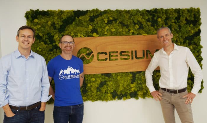 Pictured left to right: Bentley’s Chief Executive Officer Nicholas Cumins, Chief Platform Officer Patrick Cozzi, and Chief Technology Officer Julien Moutte.
3D graphics geek
Cozzi’s love of games and technology began in his hometown outside of Philadelphia. At Christmas 1987, at the age of 6, he and his brother stormed their local Clover store, racing to get their first Nintendo console. It sparked his fascination with gaming. “But it wasn’t enough just to play computer games,” Cozzi says. “I wanted to create them.” That early passion set him on the path to becoming a self-confessed “3D graphics geek,” eventually leading him to revolutionize how we visualize the world in three dimensions.
As a talented computer science graduate in 2003, Cozzi turned down lucrative career offers that would have taken him away from his beloved Philadelphia. Instead, he chose to join Analytical Graphics Inc. (AGI), a local company specializing in aerospace simulation and visualization software. “I’m like, ‘Oh, they do graphics, and they’re in Philly. Where do I sign?’” he recalls.
While at AGI, Cozzi enrolled to study computer graphics at the University of Pennsylvania. The topic of his master’s thesis was hierarchical level of detail (HLOD) — a technique for optimizing real-time rendering of spatial data, such as massive 3D cities. His connection with the university didn’t end at graduation: He later returned to teach about graphics processing unit (GPU) programming and architecture, mentoring a new generation of local developers, some of whom would join Cesium’s ranks.
Going to space
 Cesium Moon Terrain model, a comprehensive 3D representation of the lunar surface that could support lunar exploration, construction and mission planning.
In 2011, Cozzi saw a pivotal opportunity for the future of 3D technology. At the time, he was leading Cesium as an AGI project seeking to visualize objects in space. Cesium grew out of Cozzi’s expertise in both computer graphics and 3D geospatial technology. “It was the coming of age for 3D on the web,” he says. “We thought, let’s take everything we learned about high fidelity visualization, and let’s do it on the web and make it openly available to software developers, not just aerospace engineers.” Cozzi said his team created “the world’s most accurate, performant and time-dynamic virtual globe.” They called it Cesium, after the element used to build the most accurate atomic clocks, and released it as open source.
When the AGI board asked, “What new markets will this open up?” Cozzi admits he didn’t have an answer. “Instead, we opened our ears and eyes to the developer community, welcoming people with diverse use cases who needed this type of real-world visualization,” he says.
Returning to Earth
Although Cozzi first focused on aerospace and satellite imagery, fate seemed to want Cozzi and Bentley to meet. AGI has long been in Exton, Pennsylvania, where Bentley also has its headquarters. But it still took five years before their spheres actually overlapped, in 2016, when Bentley was developing what would become its digital twin technology, iTwin, a platform for infrastructure digital twins.
Bentley has since created high-resolution digital twins of buildings, cities and even nation states. But back then, the company faced a challenge: efficiently managing and visualizing vast amounts of 3D geospatial data.
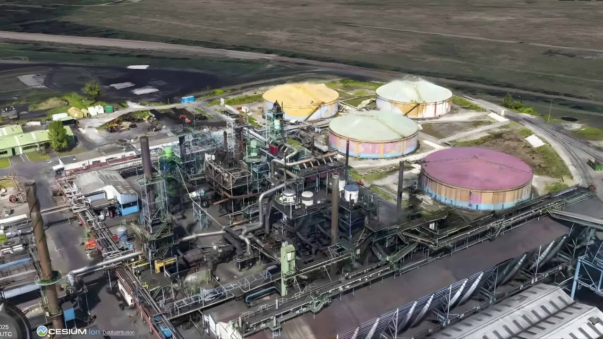
This is where Cesium’s pioneering work with 3D Tiles came into play. Born out of Cozzi’s HLOD research, 3D Tiles offered a solution for streaming massive, complex datasets in real time — whether it’s a LiDAR point cloud, an engineering model or high-resolution photogrammetry of a cityscape.
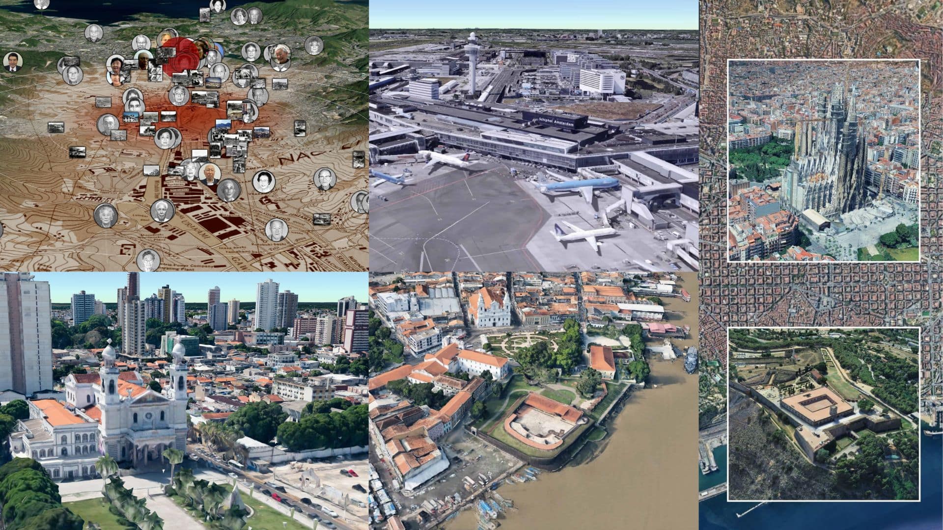
If you’ve used Google Maps, you’ve experienced the power of photorealistic 3D Tiles. This open format enables breaking down vast, overlapping sources of geolocated data into manageable pieces that can be streamed as an interactive experience to any device — from web browsers to virtual reality headsets.
Bentley quickly saw the potential of 3D Tiles for its digital twin initiatives and became an enthusiastic supporter. The relationship with Cesium proved so fruitful that Bentley backed Cesium’s successful effort to make 3D Tiles an official open standard with the Open Geospatial Consortium. In 2019, Cesium was spun out of AGI.
A great opportunity
 3D rendering of Paris looking down the Seine River during the 2024 Olympics.
Today, engineering and construction firms worldwide are seeing the combined benefits of Bentley and Cesium technology. For example, Komatsu — one of the world’s largest construction equipment manufacturers — uses Cesium’s 3D geospatial technology to monitor construction sites globally and perform precise measurements. By integrating these capabilities with Bentley’s digital twin solutions, Komatsu has improved the efficiency and safety of its construction projects.
“Our missions dovetail beautifully We’re driving toward the same goal, just from different angles,” says Cozzi. He noted that Cesium’s roots are in aerospace and large-scale geospatial mapping of the natural world, and Bentley’s expertise is in the intricate details and layered data of the built environment. Cesium sought to visualize infrastructure at scale, while Bentley aimed to place its detailed infrastructure models in their broader geographical context.
Following Bentley’s acquisition of Cesium, completed on Bentley’s 40th birthday in September, Cozzi was made chief platform officer of both Cesium and iTwin. “I have always had a mutual admiration and a shared DNA with respect to open source and open standards, building a platform to support many different developers,” Cozzi told the podcast Building The Open Metaverse after the deal closed. “Clearly the product’s energy and platform’s energy are continuing to increase there. So we said, ‘It would be a great opportunity to join forces to mutually dial up our vision.’”
The sky is no limit
Millions of sports fans recently got a taste of Cesium’s capabilities during the 2024 Olympic Games. With events held across France, NBC Sports needed a dynamic way to showcase the geographical contexts of the various events. Using Cesium for Unreal, the network combined 3D models of sporting venues with photorealistic 3D Tiles provided by Google. The result? Viewers soared across beautifully rendered Paris, from women’s badminton at La Chapelle Arena to men’s beach volleyball beneath the Eiffel Tower.
This ability to represent and stream vast amounts of 3D data in real-time is being embraced across multiple fields. Even the sky is no limit: In August, Cesium announced Cesium Moon Terrain model, a comprehensive 3D representation of the lunar surface that could support lunar exploration, construction and mission planning. Back on Earth, Lockheed Martin is using Cesium to track and visualize the spread of wildfires in near real-time, providing incident controllers with accurate 3D maps for critical decision-making. Cesium is also diving deep, helping to visualize the seabed using data gathered by deep-sea exploration submersibles.
Leveling up
Beyond geographic proximity and business alignment, Cesium and Bentley share a deep commitment to openness and community engagement. Both companies believe that the best way to propel their industries is through collaboration and transparency. Cozzi echoes this ethos. “Like Bentley, I’m committed to the long game, which means making decisions for the collective benefit of the entire ecosystem,” he explains. “With open standards, companies and developers come together to contribute their best solutions, and everyone benefits.”
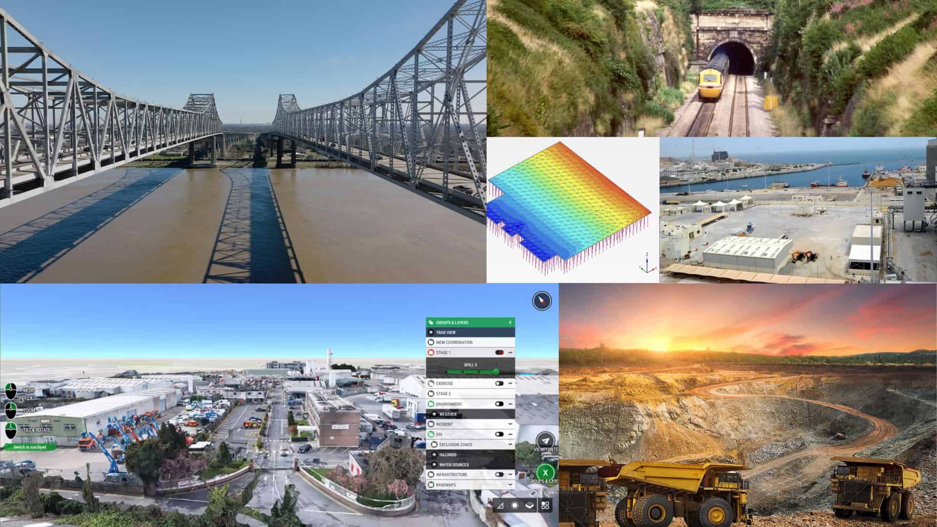
The partnership between Bentley and Cesium is fueled by a shared vision for the future of digital infrastructure. Bentley’s iTwin platform is revolutionizing how we design, build and operate the built environment, while Cesium sets new standards in real-time 3D geospatial visualization. Together, we are building a robust foundation for digital twins — dynamic, integrated models of real-world assets that can be used for everything from urban planning to environmental monitoring and emergency response.
The era of geospatial visualization is just beginning, and Cesium and Bentley — along with the developer communities so central to our success — are poised to lead its evolution. “Together, both Cesium and Bentley can go further, faster,” says Cozzi. “We’re going to be rolling at a whole new level.”
For Cozzi, this collaboration is about more than just technological progress. “Yes, it’s about impact for infrastructure and business, but it’s also about legacy,” he says. “At Bentley’s 40th birthday celebrations, [Bentley founder] Keith Bentley came over to me, really happy, and put his arm around me. I felt like I’d come home.” And from Cozzi, that is quite the compliment.

