One day a decade ago, when Mark Pittman was a student at The University of Utah in Salt Lake City, he got caught in a snarl of traffic caused by a broken traffic light. The line was barely budging, and he was growing irritated. He knew he would be late for his class. But then a different kind of light sparked in his mind, illuminating a path from frustration to opportunity.
The result was Blyncsy, a startup using AI, machine vision and cloud computing to monitor road conditions, find problematic spots and help departments of transportation maintain their road networks. Since its launch in 2014, Blyncsy has emerged as the industry leader in providing intelligent roadway insights, automated asset management, and near real-time status updates to local and state transportation departments.
AI drives highway repairs
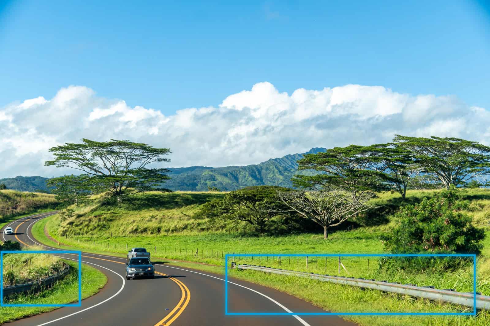
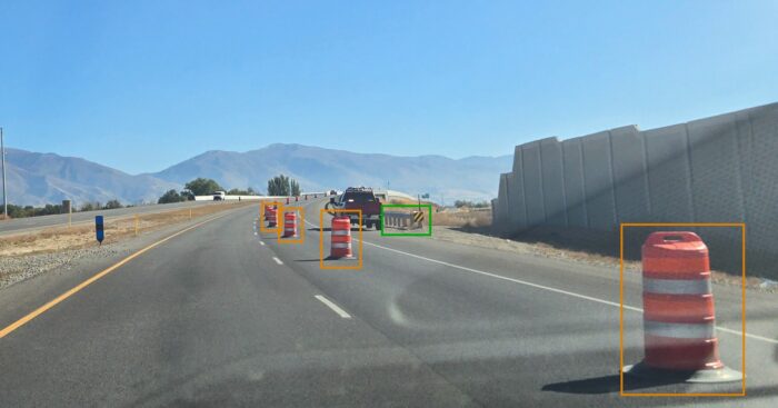 Blyncsy’s interstate highway map can detect over 40 different road conditions and asset inventory issues.
The company is now celebrating a milestone: The release of a comprehensive public map of all interstate highways in the continental U.S. The AI-powered map shows key roadway assets such as guardrails, speed limit signs and work zones to support roadway safety and maintenance conditions.
The data is available to all state U.S. Department of Transportation (DOT) agencies, enabling them to better address safety, maintenance and repair operations of deteriorating and at-risk roads. The map makes that process more efficient and cost-effective, especially during times of natural disasters. Plus, the data is delivered through an open API, providing transportation agencies a solution that is infinitely scalable.
“With increasing workloads and smaller budgets, state DOTs need a way to improve roadway safety and operational efficiencies,” said Pittman, now Bentley’s director of transportation AI and CEO of Blyncsy. “Today we’re supporting a national digital infrastructure vision and democratizing roadway data.”
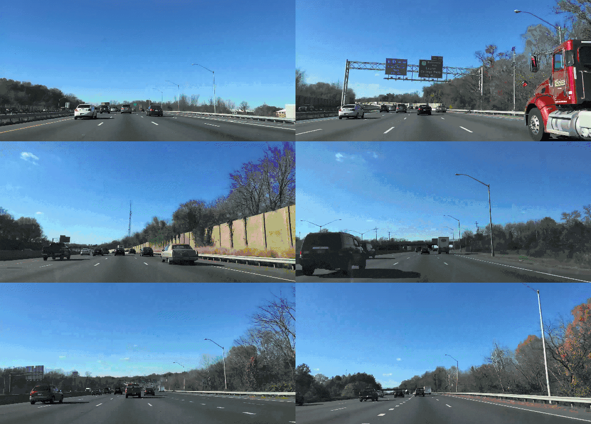
Bentley Systems, the infrastructure engineering software company that acquired Blyncsy last year, noted that the new map uses crowdsourced dash camera images from more than 1 million vehicles on the road today. When coupled with Blyncsy’s powerful AI image analysis toolset, the new map can detect over 40 different road conditions and asset inventory issues in near-real time. These issues include potential roadway safety hazards from guardrail damage, missing signage and lack of proper road striping to roadway vulnerabilities from crashes, natural disasters and work zone areas.
Laura Chace, president and CEO of ITS America, lauded the news. Her organization advocates for a smarter, greener future transformed by transportation technology and innovation. “The application of advanced technologies like AI, combined with new sources of data, are transforming the transportation sector, giving us better information as we make investments in safety and mobility,” she said. “We applaud companies like Blyncsy for deploying these forward-thinking technologies and making this digital infrastructure data available to the public in an accessible format.”
On the Road with AI
Blyncsy gets road pictures by crowdsourcing images, including privately owned commercial and fleet vehicles and delivery trucks. The company anonymizes the data and securely stores it in the cloud, where it can be studied and analyzed by machine learning systems and AI. Blyncsy detects over 50 different roadway safety issues, including the actual location of active construction work zones. The research can make roads smarter and safer, and ensure they meet the latest regulations.
Take retroreflective road markings as an example. You’ve seen them when driving in the dark: They mark lanes and other road features. As the name suggests, the markings are designed to reflect light back to the source and make them appear brighter—which is crucial, especially at night. In 2022, the Federal Highway Administration (FHWA) issued a rule calling for minimum retroreflectivity levels for pavement markings on roads with speed limits of 35 mph or greater by 2026.
That means state and local governments must guarantee the headlight-reflecting capability of the white dashed lines in the middle of higher-speed roads. The rules are aimed at improving safety for senior drivers, lane-assist sensors and self-driving vehicles.
A Shining Example
The traditional method for government agencies to check the markings requires sending a human inspector to a small sample of locations for a visit and then a whole lot of extrapolations and guesswork. The process is expensive, laborious and inaccurate—and mandatory federal compliance is less than two years away.
Just in time for the White House’s Infrastructure Week 2024, Blyncsy released a that rates retroreflectivity for roads within all 50 state capitals. In just four days, Blyncsy used its nationwide image crowdsourcing network and its AI technology to detect and capture over 3,200 centerline miles of paint retroreflectivity. The technology used images from multiple corroborating angles across various light conditions.
These fast results provide insights that agencies need—and offer an estimated 90% reduction in the costs and burdens associated with paint-line inspections. Maintenance crews across the nation can identify where and when to paint new lines on the roads, improve safety, reduce operational costs and comply with new road requirements. The technology can also help provide safer navigation for both human and automated drivers.
“AI is enabling a revolution,” Pittman said. “We’re making sure our public servants benefit from this revolution as well.”
Avoiding Pitfalls (and Potholes) with Real-Time Data
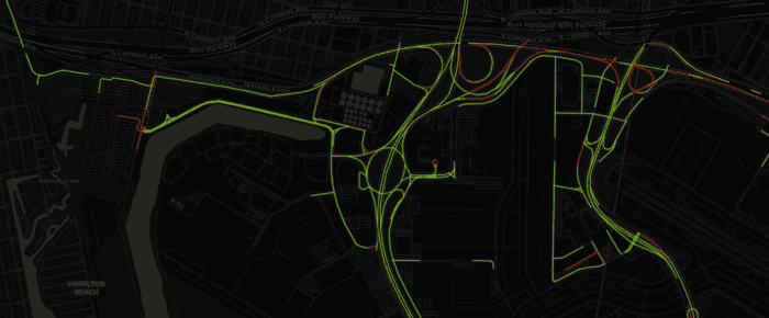 Blyncsy’s imagery map shows the detection of designated roads in every U.S. state and a sample reflectivity score for every capital city.
Last year’s acquisition by Bentley underscores the value of Blyncsy’s smart approach to managing infrastructure. Blyncsy teams and technology can extend the life of roadways and reduce carbon emissions by fixing and spotting problems early.
“We can help to extend the life of roadways by detecting and repairing potholes while they are still small,” Pittman said. “If not addressed until they are more advanced, potholes can degrade the road base and may require ripping out the road itself.”
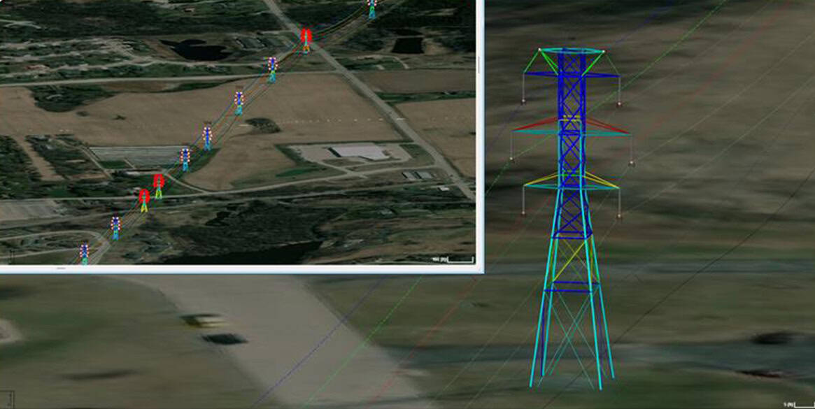
Blyncsy holds an important role in Bentley’s vision for the future, particularly in how it can continue to evolve iTwin, its platform for infrastructure digital twins. A digital twin is a virtual representation of a road, building or even an entire city. By incorporating real-time mobility data into its digital models, Bentley can offer a more comprehensive and accurate representation of infrastructure usage. This could significantly improve planning, design and the predictive maintenance of projects.
“Bentley has always focused on safety and efficiency across the globe, from day one,” said Mike Schelhase, Bentley’s vice president for asset analytics. “With Blyncsy, we’re now able to support every state in building and maintaining a safer and more equitable road network.”
The Road Ahead
Looking ahead, Blyncsy’s capabilities are also crucial in preparing for a future of self-driving vehicles. Pittman said Blyncsy is well positioned for the next step in infrastructure.
“Our AI technology offers essential data on traffic patterns, road conditions and user behavior,” he said. “They are invaluable for the development and safety of autonomous transportation systems, ensuring they are both efficient and secure.”
Not a bad outcome for getting stuck at a faulty red light.
Thomas Kohnstamm is a journalist writing about technology and a book author. His new novel, Supersonic, will be out next year.
A version of this story ran in May 2024.

