Traffic modeling challenges in growing suburban communities
Sherburne County is a fast-growing suburban county in the Minneapolis–St. Paul region, facing increasing commuter pressure, longer travel times, and emerging bottlenecks as development expands beyond the metropolitan core. SRF Consulting, a full-service transit consulting firm, was contracted to produce traffic models for the region, but encountered a common challenge for medium-sized communities. Existing regional travel demand models are essential for metro-wide planning (including evaluating major policy and mode shifts), but they are often not designed to support development-level operational questions in outer areas. In Sherburne County’s case, SRF discovered several limitations that made it difficult to evaluate local projects and near-term operational alternatives:
- Network detail gaps, including lower facility-type roads which are often excluded.
- Zone systems too coarse for local decisions, as the county was represented with a limited number of
- Intersection delay and control strategies not represented, limiting the evaluation of signal timing optimization and other control modifications.
- Static traffic representation of local congestion patterns, which is useful but can be harder to translate into time-dependent congestion, diversion, and bottleneck behavior needed for operational planning.
At the same time, building a robust dynamic traffic assessment model typically requires a data-heavy workflow that includes routable networks with additional detail, detailed signal controls, and calibration against time-series counts. These models also need time-varying origin-destination demand, often beyond what smaller communities can assemble from a time and cost perspective.

Mesoscopic traffic modeling using Bentley OpenPaths Patterns and DYNAMEQ
SRF Consulting’s solution was to assemble a mesoscopic traffic simulation and dynamic traffic assignment model for Sherburne County. This approach supplements macroscopic regional modeling with dynamic traffic assignment on higher-resolution networks, enabling wider-area analysis that is beyond the practical capabilities of microscopic models.
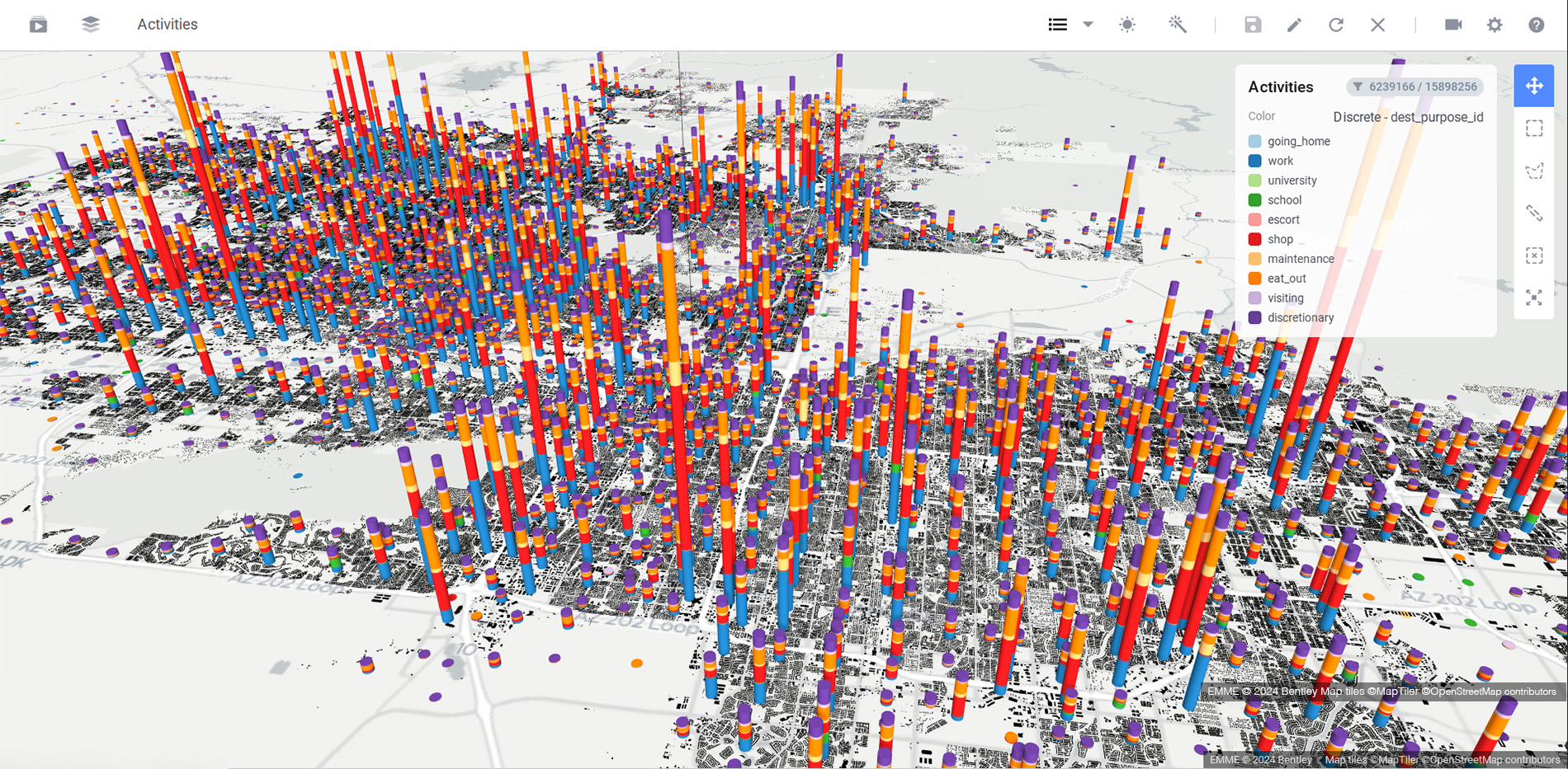
Building a mesoscopic traffic simulation model with big data
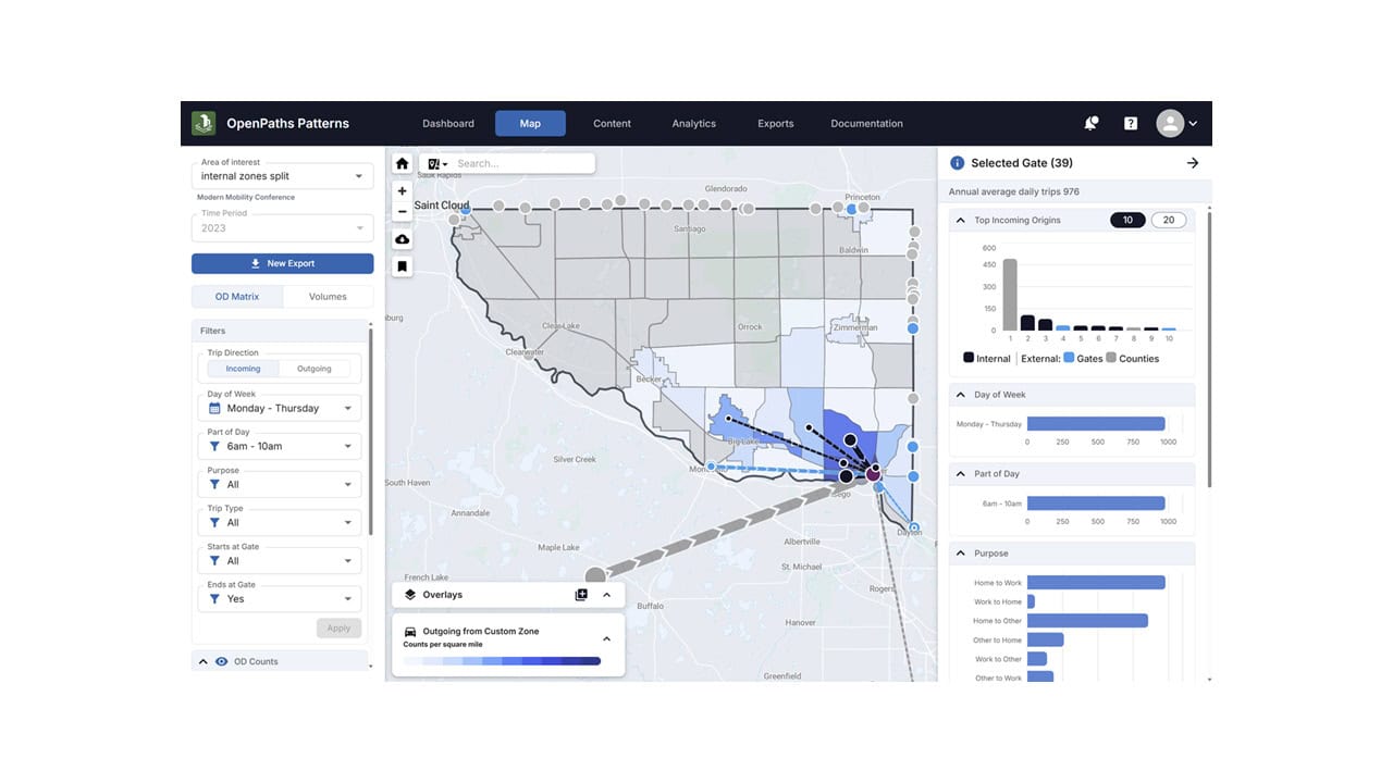
1) Data foundation with Bentley OpenPaths Patterns
To overcome the typical data barriers, SRF used Bentley OpenPaths Patterns to gain instant access to key inputs, including:
- A routable roadway network: Bentley OpenPaths Patterns provided an all-streets routable network derived from OpenStreetMap, which was then refined in Bentley OpenPaths DYNAMEQ with additional intersection geometry referencing aerial imagery basemaps.
- Origin-destination: Bentley OpenPaths Patterns provided distinct origin-destination matrices by time-of-day, which were later disaggregated against traffic volumes using Bentley OpenPaths DYNAMEQ’s simulation-based matrix adjustment.
- Traffic volumes across the entire network: Bentley OpenPaths Patterns provided average hourly roadway volumes for use in adjustment, calibration, and model preparation procedures, specifically for a morning analysis window.
Bentley OpenPaths Patterns also enabled SRF to characterize travel movements in ways that are particularly important for medium-sized counties with strong commuter flows. For example, SRF summarized trip types during the morning peak, including internal–internal, internal–external, external–internal, and external–external, then determined that a large share of trips crosses the county boundary, an important driver of route choice and congestion dynamics.
2) Mesoscopic simulation and dynamic traffic assessment with Bentley OpenPaths DYNAMEQ
SRF then implemented the simulation model in Bentley OpenPaths DYNAMEQ for the morning transit period across Sherburne County.
Bentley OpenPaths DYNAMEQ provides high-fidelity vehicle-based traffic simulation to support operational traffic planning by capturing essential traffic behaviors, including car-following, gap acceptance, -changing, and explicit representation of traffic signals. This simulation provides a scalable approach for reliable scenario planning and comparison not traditionally possible with microscopic models.
3) Traffic model calibration for accurate simulation
The simulation development process emphasized a practical, repeatable workflow rather than an extended, multimonth build. The key improvements included:
- Network refinements to ensure connectivity, facility types, and controls represent the real system. SRF used Bentley OpenPaths DYNAMEQ to automatically create default intersection geometry and turn alignments from the imported road network data, and to synthesize representative signal timings without requiring additional data sources.
- Demand and origin-demand calibration prepared using the Bentley OpenPaths DYNAMEQ simulation-based dynamic matrix adjustment process. The procedure was used to disaggregate the morning origin-demand matrix and produce 16 origin-demand trip tables at 15-minute intervals across the morning period, while matching available hourly traffic volumes. These trip tables were then assigned directly in Bentley OpenPaths DYNAMEQ.
Importantly, SRF framed the effort as a demonstration of capability and accessibility, showing how big data can make dynamic traffic assessment model development more feasible for communities with limited funding for both macro and micro modeling efforts.
Scenario planning and “what-if” traffic analysis at scale
With a mesoscopic dynamic traffic assessment model in place, SRF could produce analyses that are difficult to reliably produce with regional tools combined with post-processing, including:
- Trip diversion and route choice shifts under a “what-if” scenario compared to a base case, using link volume comparisons by period and time interval.
- Bottleneck and hotspot identification using time-dependent congestion patterns instead of static period assumptions.
- Communication-ready visualization to support stakeholder meetings and public engagement, helping technical teams explain congestion dynamics and the implications of alternatives.
This is directly aligned with Sherburne County’s relevant project types and planning needs, such as signal replacement, alignments, and capacity improvements, and supports the requirement to consider greenhouse gas emission impacts for certain capacity-related projects.
Faster traffic model development with scalable workflows
SRF’s work demonstrates the practical value proposition for medium-sized communities, including:
- Reduced dependence on assembling many separate data sources by leveraging Bentley OpenPaths Patterns for routable networks, time-of-day origin-destinations, and observed volumes.
- A repeatable pathway to enhance operational traffic planning capabilities with Bentley OpenPaths DYNAMEQ that complements the needs of fast-growing counties alongside regional tools.
- A foundation for rapid scenario testing for quick-turnaround “what-if” workflows needed for operational traffic planning on corridor and development-driven decisions.
SRF emphasized that having traffic data readily available and efficiently extracting origin-destination demand substantially reduces the effort required to get to a functioning model framework.
Quote: “In developing the Sherburne County dynamic traffic assessment model, the Bentley OpenPaths Patterns data provided the required data to develop and calibrate the model. Having the traffic data available and the ease of extracting origin-destination data greatly reduced the model development time.” – Florence Ngai, Project Manager, SRF
Quote: “Bentley OpenPaths DYNAMEQ is an effective tool to supplement regional macroscopic (i.e. travel demand) modeling with a dynamic assignment approach using higher resolution network details, and to perform wider-area network analysis not feasible for conventional microscopic simulation.” – Ben Nault, Project Manager, SRF
Why mesoscopic traffic modeling matters for operational planning
Medium-sized communities, especially fast-growing outer counties, often need an approach that is:
- More operationally detailed than a regional planning model
- More scalable than micro-simulation everywhere
- Feasible without multimonth data collection programs
By combining Bentley OpenPaths Patterns and Bentley OpenPaths DYNAMEQ, SRF demonstrated a viable and cost-effective path: big data inputs to reduce startup friction, and mesoscopic dynamic traffic assessment to answer the operational questions that frequently arise in development-led growth environments.
Explore how Bentley OpenPaths Patterns and Bentley OpenPaths DYNAMEQ improve operational planning and scenario analysis for growing communities.