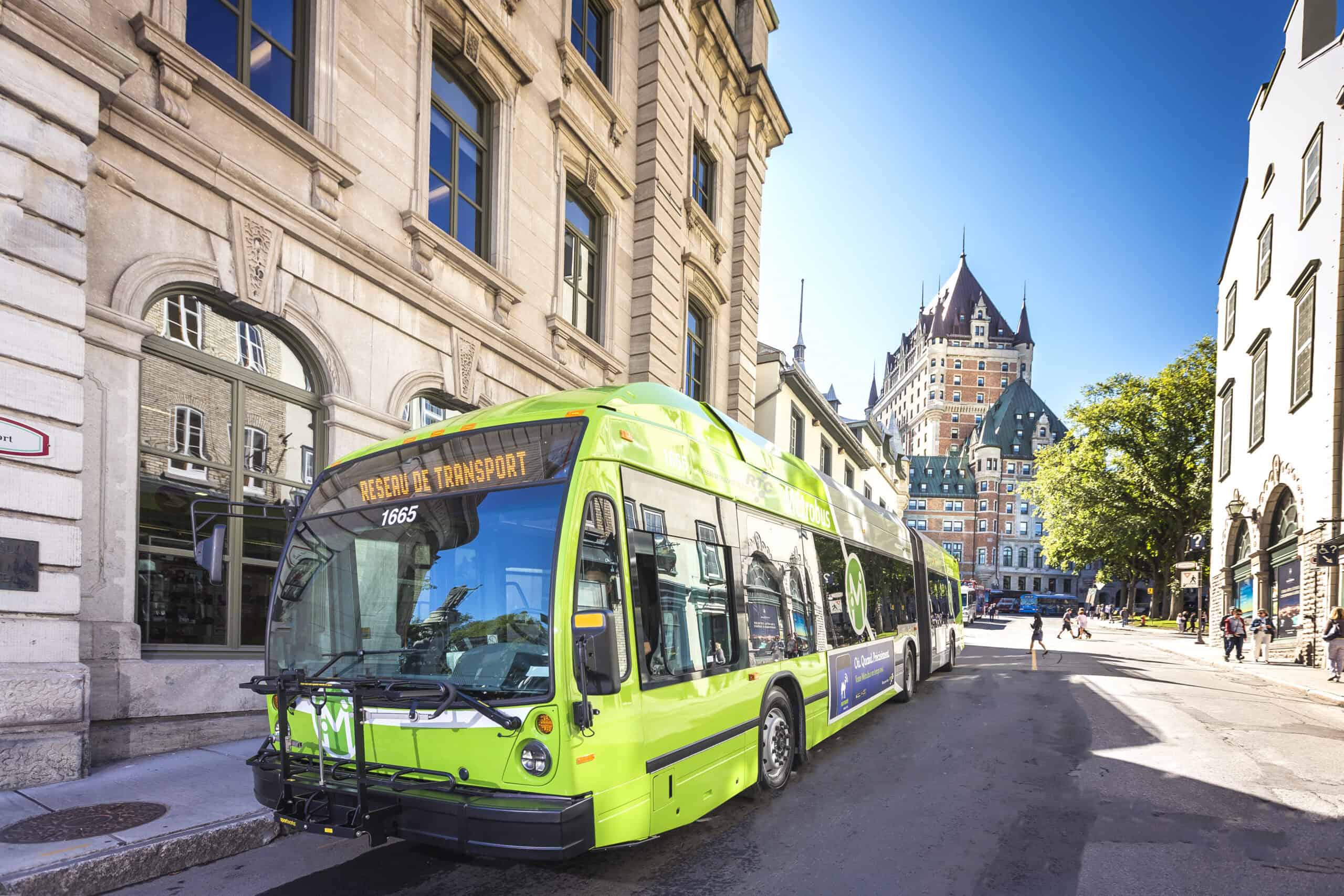
Dynamic Traffic Assignment (DTA) is a cutting-edge traffic modeling approach that plays a crucial role in modern traffic management and transportation planning. Unlike traditional static models, DTA simulates traffic movements on a detailed representation of the road network and traffic management system to provide a more accurate and responsive analysis of traffic flow. This advanced model can support various applications, from regional-level evaluations of travel behavior to corridor-level traffic management, including bus rapid transit (BRT) operations and signal optimization. Recently, ITE Canada recognized the Regional Municipality of York and their project “York Region DTA Model – A Next-Generation Transport Planning and Operations Tool,” as one of five projects nominated for the 2025 ITE Transportation Achievement Award. This prestigious award highlights projects with significant contributions to the field of transportation engineering and their impact on improving traffic management and mobility.
Unveiling the York Region DTA Project
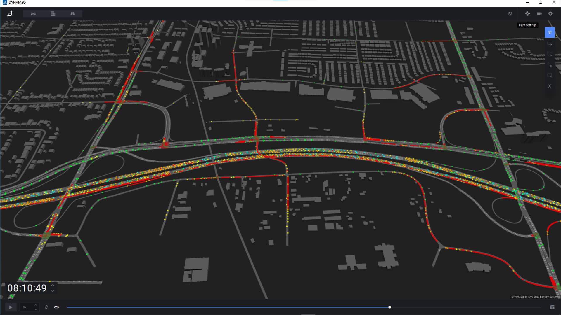
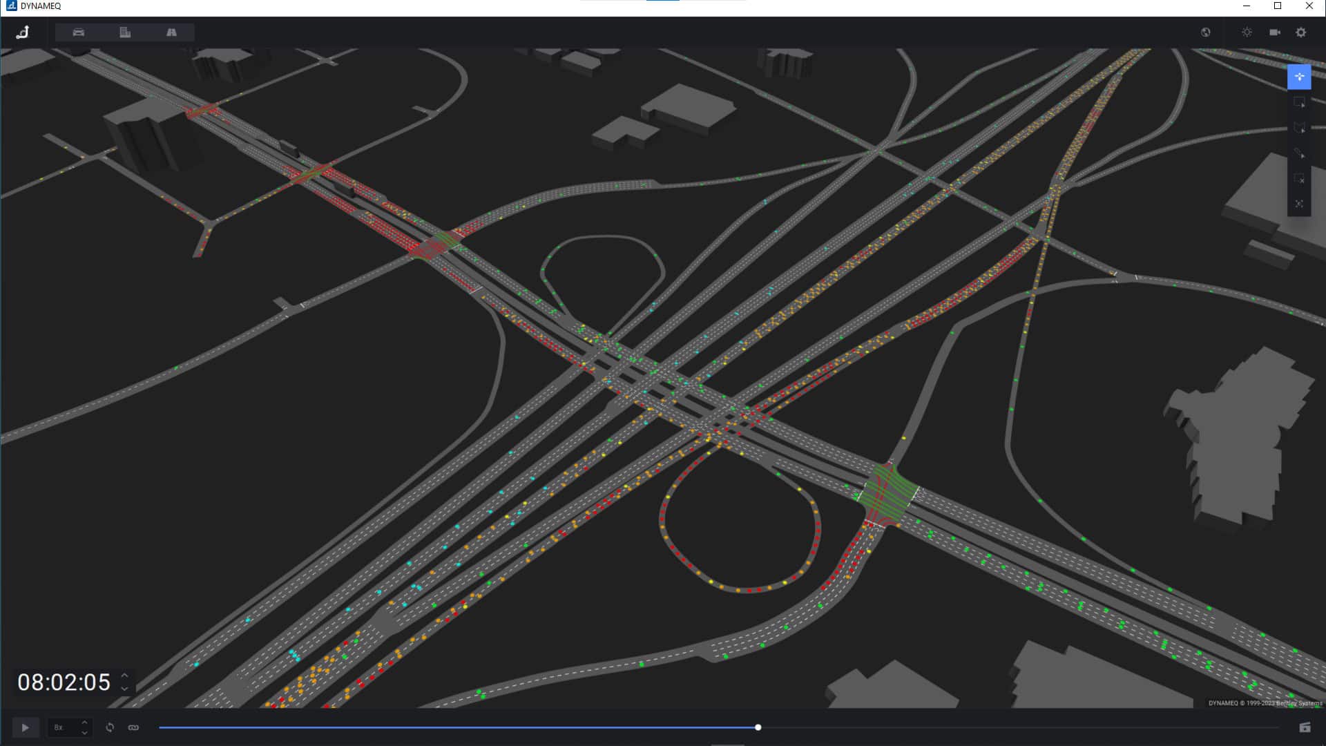
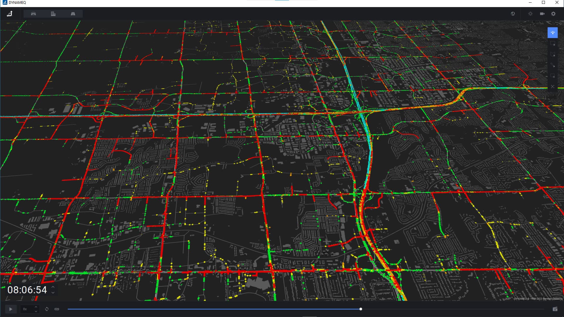
The York Region DTA Model is an innovative project designed to enhance transportation planning and operations in one of Canada’s fastest-growing areas. Developed using Bentley’s traffic simulation software, Bentley OpenPaths DYNAMEQ, this mesoscopic model bridges the gap between traditional static models and highly detailed microscopic simulations, offering a versatile tool for regional and corridor-level analysis.
Project Overview
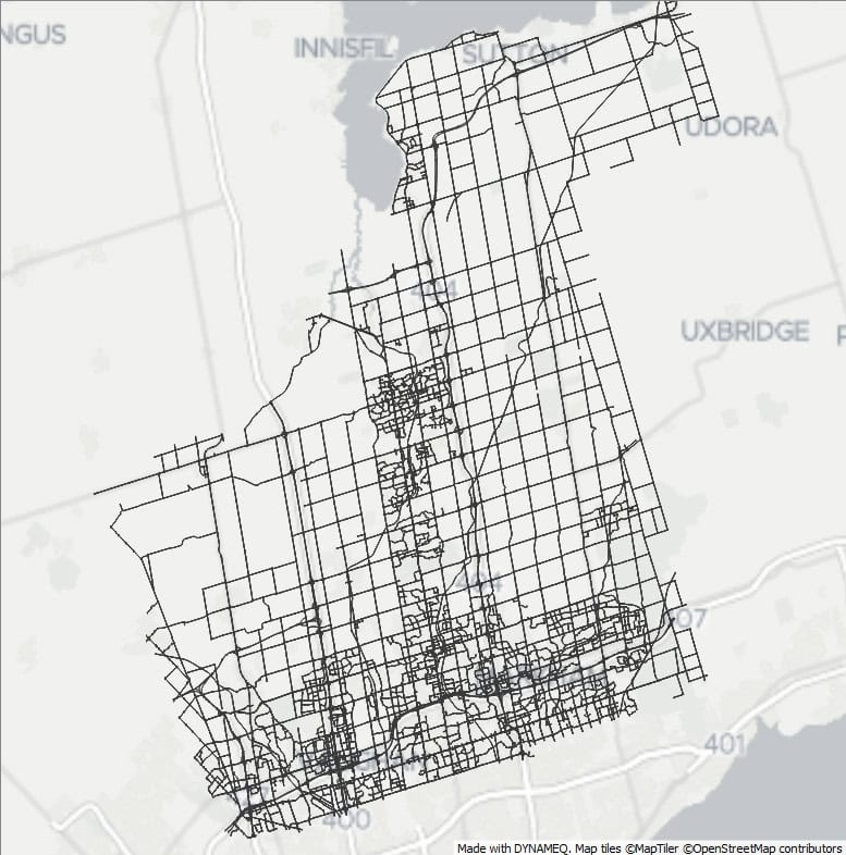
The DTA Model covers a vast area of 1,762 square kilometers, making it the largest of its kind in Canada. Bentley OpenPaths DYNAMEQ provided a unified modeling environment, allowing the region to manage time-varying demand, signal interactions, routing behavior and assignment within a single platform, helping to streamline the process by reducing the need to switch between tools. This singular model replaces multiple traditional model sets and inputs, making decision-making more efficient and effective.
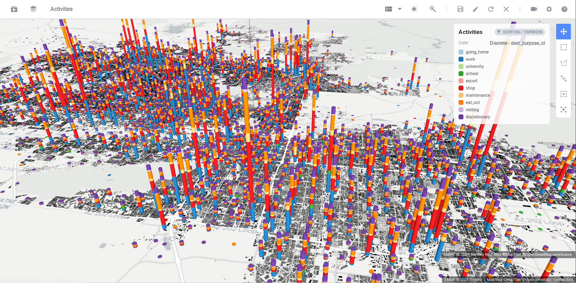
The model utilized Dynamic User Equilibrium (DUE) to assign trips based on travel times obtained with a mesoscopic traffic simulation model. It includes advanced features such as simulation-based demand matrix adjustment, and comprehensive APIs to support automated data processing with Python scripts. The model was thoroughly evaluated and validated using data from over 400 locations to ensure accuracy in predicting both traffic volumes and travel times.
Driving Innovation and Streamlining Automation
The DTA Model integrates data from York Region’s Activity-Based Model (ABM), reducing the need for manual adjustments in traffic volume modeling for future scenarios. Automation played a significant role, with Python scripts utilizing a variety of APIs reducing data entry time by about 50% and Bentley OpenPaths signal timing generator optimizing control settings for future traffic flow conditions. The model was used to test various scenarios, including construction impacts, transit signal priority strategies, and HOV lane conversions.
Safety, Mobility Improvements, and Cost Savings
The traffic modeling approach helped to improve traffic flow by identifying high-congestion areas and supporting transit priority measures. For example, it was used to assess the Highway 7 BRT system, considering optimal lane placements to reduce delays.
In terms of cost-effectiveness and implementation feasibility, the DTA Model reduced analysis time by 60% compared to traditional models, which translates to substantial time and cost savings. Although the DTA model does not fully replace operational-level analysis tools, it often provides a sufficient level of detail for uses such as conceptual design, construction staging, and broader network assessments, without the overhead of developing and calibrating operational-level models. The model helped the Regional Municipality of York avoid unnecessary road widenings, potentially saving millions in infrastructure costs and helped support better staging of construction projects to reduce disruptions.
What’s Next: Future Enhancements and Scalability
Plans are underway to include a full integration of the DTA model with the ABM. This integration will enhance the model’s ability to simulate individual travel behaviors and their interactions with the network, providing more accurate traffic predictions and setting a benchmark for other regions.
A Modeling Approach to Follow
The York Region DTA Model is a notable example of using Bentley OpenPaths DYNAMEQ as a scalable transport modeling platform to help improve traffic flows, manage congestion, and minimize infrastructure costs. This project established a new standard for dynamic traffic modeling, providing an innovative framework for other metropolitan areas to follow.
About Bentley OpenPaths
Bentley OpenPaths is Bentley’s multimodal transportation planning software, including DYNAMEQ, CUBE, EMME, AGENT, and CityPhi applications.
Bentley OpenPaths DYNAMEQ includes everything needed for traffic simulation and dynamic traffic assignment modeling, including high-performance 3D animations for visualization and analysis, and the ability to rapidly develop models of any size with importers for various transportation software and data formats. The software streamlines model development with robust data validation and cleaning capabilities, making it easy to identify and resolve issues. It also supports the development of future scenarios by synthesizing traffic signals and turning movement parameters adapted to future travel demands.
Do you have a traffic scenario you would like to simulate? Learn more about Traffic Simulation and Dynamic Traffic Assignment or talk to an expert.