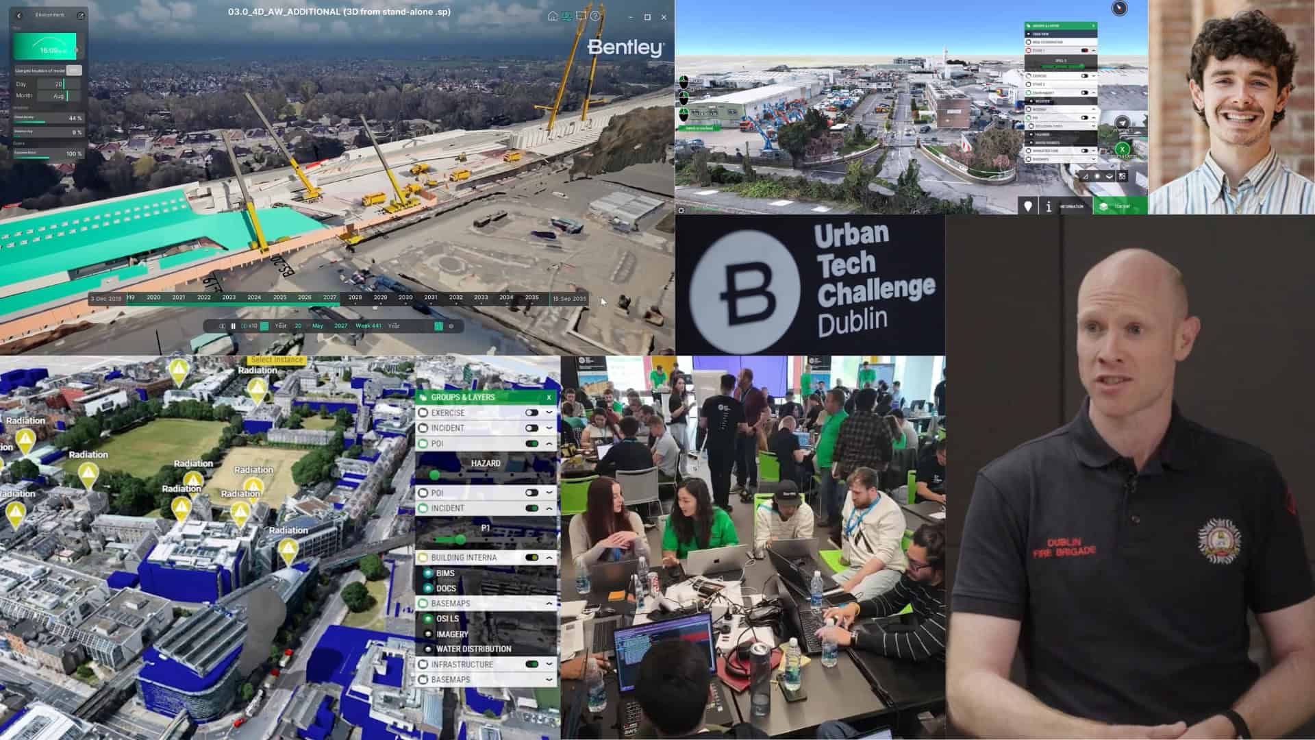
 Aerial view of a city intersection with digital overlays, displaying a citizen engagement platform interface and a suggestion list for community feedback on the right side.
Pau’s digital twin is a great example. It sits at the heart of city planning and operations. Municipal departments use it to simulate traffic scenarios, manage utility networks, model architectural projects, track progress towards sustainability goals, and even prepare for sporting events—all while sharing information and soliciting citizen feedback.
During my visit, I was able to explore specific examples, first on the computer screen and then see the outcome in real life. One of Pau’s major projects included the redevelopment of Boulevard d’Aragon into a leafy oasis in the city center, and the improvement of the Avenue Saragosse thoroughfare. The city’s digital twin allowed planners to model the removal of structures in the middle of the boulevard and transform it into a pedestrian-friendly space. The avenue has become an inviting space for locals, sporting cycle paths, pedestrian walkways, and tree-lined areas that replaced concrete parking areas. The result is a more inclusive and sustainable environment.
The digital twin also helped upgrade the Les Halles market. Technicians and engineers used the digital twin to collaborate, model their ideas, and integrate project components including materials, cladding, furniture, and trees. The city also revitalized Le Foirail, a formerly neglected neighborhood with abandoned buildings. Planners used the digital twin to communicate their plans to residents and other stakeholders about how to reduce the number of cars, plant trees, and create parks and a cultural center. Today, Le Foirail is a popular and lively district that demonstrates the potential of smart urban regeneration.
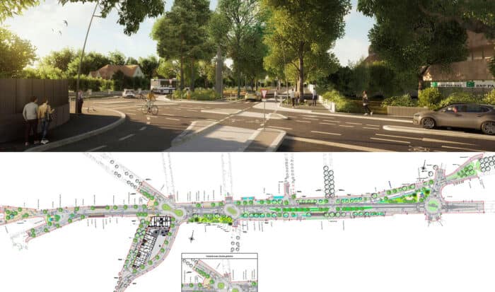 A rendering of a tree-lined urban street with pedestrians and cyclists, shown above a detailed site plan for the same street redevelopment project.
Pau is one of many cities worldwide, large and small, that use Bentley software to build digital twins. Others include Singapore, Amsterdam, Helsinki, Istanbul, and Toronto, but also the town Perry, Iowa. To me, Pau’s story demonstrates the art of the possible, showcasing the value of digital twins for cities of any size. It is a model for others to follow. Pau has proven that you don’t need to be a megacity to be a smart city that, through technology, puts the needs of citizens first.
In fact, Pau’s digital twin is so innovative that it won the Founders’ Honors prize last year at Bentley’s Year in Infrastructure and Going Digital Awards held in Vancouver, Canada. Some 250 projects were competing for the prize, which recognizes vision, execution, and impact. Only 16 projects were selected, including Dublin Fire Brigade’s digital twin for emergency response and Singapore’s AI-powered digital twin of its water network.
The purpose of that recognition wasn’t just to celebrate high achievement, but to ensure that others could replicate the results. That’s also why Bentley joined Pau to support the “Digital Twin of France and its Territories” initiative, a national effort launched by three French research institutes and public bodies: —CEREMA, Inria, and IGN.